Tuesday, 31 August 2004
Helmsdale - 31/08/04
Monday, 30 August 2004
Ullapool - 30/08/04
The hostel was virtually empty last night. Left at 9 to explore the peninsula of Faraid Head, 2 miles north of Durness. Went down the road towards Balnakiel for a little way, then turned off north. Not a terribly nice day, it's very windy. Make my way through a campsite and through a landscape of dunes. End up at Seanachaisteal Cape, from where I headed west along the clifftops. These veer north after a litttle while, and in due course I was reunited with the road. This winds its way through the dunes and the sand towards an MOD monitoring station on Faraid Head. This is off-limits. The road at times disappears under sand, but is intensively used. Have a break on the hills just south of the fence, and look west towards Garbh Eilean, the bombing target for the navy. I make my way south again and when the road peters out in the sands of Balnakiel Bay, I go down to the shoreline. I return to the road at Balnakiel village. Half a mile further down I have another look at the craft village. Have a cup of soup in the bookshop and look round the gemstone shop. The proprietrix is a large elderly lady who told me how to kill a dog.She complained about the neighbours whose dog was forever p'ing in her flowerbeds, and about all and everything. I returned to the hostel to collect my things and have lunch. The bus back to Ullapool starts at 2.45. It was strange to alone in the hostel after the convivial buzz of the weekend. Left at 2.15 to walk up the road to the starting point at the Smoo Caves. The journey back down to Ullapool took 3 hours and was the same as on the way up, albeit a little sunnier. The Youth Hostel in Ullapool still had vacancies. One of the wardens was a young Dutch lady. Nipped out to Safeways for food, then proceeded to eat it. Internet access in the village was extortionately priced, so I left that. Nice natter with some hostellers.
Sunday, 29 August 2004
Cape Wrath - 29/08/04
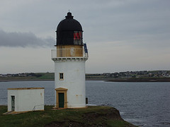
Was one of the first to be out and about in the hostel. Made my breakfast but by the time I had finished, the rest of the people had materialised as well. One person was sent across to the dormblock to sound the gong. Left at 9 o'clock, thinking it was going to be a nice day. Nope. The nice weather was fast disappearing east, and a bank of ominously grey cloud swiftly moved up from the west. By the time I reached Durness village, it was raining steadily and getting worse. Went down the lane towards the Balnakiel Craft village, which used to be an RAF radarbase. It was taken over in the 1960s by people engaged in various crafts, such as glazing, repairing musical instruments and collecting gemstones. I cannot reach Keoldale by passing through the craft village, so I rejoin the main road and head off down a farmtrack. By now, it's absolutely sluicing down. I regain the main road south after a mile, after passing some very mournful looking cattle. Trudge down the A838 for just over a mile, with a fair amount of traffic on it. I'm relieved when I can finally branch off. This is at the bottom of the hill, where the road approaches the broad inlet of the Kyle of Durness. Go down the sideroad to the hotel and to the jetty at its end. It's now 10.45, raining like hell and blowing. Find a convenient shelter and await events. A notice proclaims no ferry service for Saturday, but no further info on today. A man in an estate car says that the situation is under review. Other cars turn up whose occupants also want to got to Cape Wrath. Finally, the rain relents and stops at 11.30. A little boat is launched and sailed to a larger vessel. All who want to go across are required to board this vessel, and we make our way across the Kyle. There is a strong current, but no problems. Reach the far side in about 10 minutes. Two minibuses are parked. First of all, they have to be tanked up. Once on board, we all have to remain seated at all times. The reason why becomes clear on departure - this is part of the Queen's Highway, but it's the most atrocious 11 miles of public highway in the country. Two tarmacked rutted tracks. Nobody lives here premanently as the area is a bombing range for the Royal Navy. There is an offshore island which is pounded regularly. First we ascend to about 66 m (220 ft) above sealevel. Then we descend to a river. It's apparently luck of the draw whether the bridge is still there. It is today. There are a handful of holiday homes on the coast of the Kyle, but only one house further up the track. We bounce our way along, splashing through puddles. A hill called Fashven looms up to the south, altitude 460 m (1530 ft). After a very sharp bend, we cross another river by some MOD sentry posts. Out towards the coast, a set of rock stacks stands which look like a cathedral front. At length, 40 minutes after leaving the ferry, we draw up outside Cape Wrath Lighthouse, the end of the road. First port of call is the lighthouse and the foghorn. A ship sails round the cape at that very moment. The actual cape is not at the foghorn, but by the offshore islands. You stand 60 m / 200 ft above the sea. It is possible to walk from here to Sandwood Bay, 6 miles further south, and on to Kinlochbervie. We met two hikers on the way up. Wandered about the area around the lighthouse. This runs on generators, which start automatically. The adjacent buildings are all deserted. Buildings high on the hill to the east are only a shell. After an hour, we all climb on board the bus and head back for the Keoldale ferry. Weather has cleared up nicely. The worst of the water has drained from the road, and we hobble merrily across this desolate landscape. On approach to the pier, we can see seals on the shallows in the Kyle. A few photostops are made. The tide is out, so the boat has a spot of bother at the pier. At the Durness side of the water, I head off on foot along the shore of the Kyle. End up in a landscape ofdunes, and only slowly make progress north. Sun is nice and warm. After a lot of hassle, I finally approach civilisation through the golfcourse. Having wrung myself through a narrow gate, I presently find myself on the road past Balnakiel, the craftvillage. Didn't manage to have a good look this morning on account of the atrocious weather. It's a strange place. I drop into a restaurant for a cuppa and am even allowed Internet access. After that, I return to the hostel at 6 o'clock. The evening was unremarkable, as it's a lot more quiet than last night. Many folks left this morning to return down south.
Saturday, 28 August 2004
Durness - 28/08/04
As I dislike large towns, I make a beeline for the busstation to head out of Inverness at a quarter to nine. The bus I'm on will take me all the way to Durness, near the northwestern extremity of the Scottish mainland, 10 miles east of Cape Wrath. It's not a big bus. I start off by having a coffee in the busstation cafeteria, then I board the vehicle in question. One couple already there is mixed British / Belgian. We head off down the A9 across the Kessock bridge, through Dingwall and out up the A835 to Ullapool. We go through Strathpeffer. It's a cool and cloudy day. Just after the Braemore junction, we're allowed to stretch our legs at the Corrieshalloch gorge. The bridge spans a gorde and offers quite a spectacular view. After a sanitary stop, everybody stuffs their face and rejoins the bus. Next stop Ullapool, some 11 miles up the road. We arrive in the village at 1030, on time to watch the Stornoway ferry depart. I hop into the Woollen Mill shop to buy a fleece. It's turning gradually colder. I also need plasters for a problematic toe. Bus leaves shortly before 11. We head north through a stunning landscape of maountains, whose names I can only copy off the maps. Beinn Mor Coigach, then the sideroad to Achiltibuie, through Elphin and on to the Ledmore junction. We join the A837 north, past Canisp and Suilven. It's raining, with low clouds over the mountains. Suilven is only just recognisable. At Inchnadamph we reach Loch Assynt. The A837 heads north over the mountains, from Skiag Bridge. This bus diverts a mere 11 miles to the coast to reach Lochinver. To the right, the convoluted mass of the Quinag rears up, not very far to the north. A fairly steep descent takes us into the fishing port of Lochinver. It's dry now, but still not terribly warm. We're allowed off again, to look round the visitor centre. WQuite nicely laid out. We depart at 12, retracing our steps to Skiag Bridge, then rise from 71 m to 238 m in 1½ miles to crest the pass between Quinag and Glas Bheinn. As stated before, Quinag is a massive mountain with 3 large spurs. The road veers downhill and presently Loch Glencoul and the bridge at Kylesku loom up ahead. We pass through Unapool and finally cross the bridge. We quickly rise up again, but the views from the bridge were very good. Next village is Scourie, which is a bit of a one-horse town. Six miles further up the ocast, we change from A894 (as of Skiag Bridge) to the A838, which will take us to Rhiconich, at the head of Loch Inchard. The narrow B801 road leads to another fishing port, Kinlochbervie. We turn round at the fishmart and drop the Belgian / British couple off at their accommodation. I stay on right through to Durness. This is actually the next village beyond Rhiconich, if 11 miles distant. Pass through a bleak and desolate landscape, where you can see for miles. To the left lie the derelict lands of An Parph, the district surrounding Cape Wrath. The A838 passes along the eastern shore of the Kyle of Durness to Keoldale, where the ferry sails to An Parph. We arrive into Durness village just before two. The driver very kindly drops me off at the youth hostel, which is located at the eastern end of Durness, near the Smoo Caves. The hostel is as yet closed, so I walk back to the TIC on Sango Bay. This is very scenic, it's an official swimming beach with stunning coastal scenery. The main road loops inland for half a mile, but there is a very steep short cut. Go for a walk out towards Loch Meadaidh, south of the village. A vehicle trail leads there, Find a man mending a gate. I head northwest towards Loch Calladail. Bit breezy this afternoon, but now pleasantly sunny. Return into Durness from there, and do some shopping for the weekend. Nothing opens here on Sunday, so I've got to be prepared. The only thing is that the local convenience store doesn't have a large variety of foods. Return to the hostel at 5, and am being welcomed by the warden. He has got Tibetan prayerflags up, windchimes and the lot. The hostel consists of two buildings, separated by a stretch of lawn. One building is the dormitory, the other the main hostel building with kitchen and common room. Hostel is fairly lively at the moment, with a German family out of Hamburg and a British family. It's the weekend. I cook my food, then go out for a walk to the Smoo Caves at 8 o'clock. These are just a few hundred yards up the road. I could not go in far on account of high water. The water from the Smoo river plunges into a sinkhole, down into the cave. You do get wet in there. Hobble back to the hostel. Conduct a phone conversation at 10 o'clock, when it's nearly fully dark outside. It's not very cold.
Friday, 27 August 2004
Inverness - 27/08/04
Spent the morning sorting things out. I'm sending excess stuff off by mail, then board the ferry at 12.40 to return to the mainland. It's a bright day. The crew use the time until arrival at Ullapool cleaning and painting the ship. On arrival at Ullapool, a bus stands ready to take footpassengers on to Inverness. It's green until Braemore Junction, where the road rises to go up onto the moors. Past Loch Glascarnoch, where a webcam is located for the Met Office. At Garve, we cross the railway to Kyle and head further east. Bus branches off to go through Strathpeffer before rejoining the main road towards Inverness. At Dingwall, we go down the A9 dual carriageway towards Kessock. The bridge matrix signs warn of high winds. We arrive at Inverness at 5 o'clock, in the middle of the evening rush hour. Walk from Farraline Park busstation to the railway station and into the Eastgate Shopping Centre. Notice the Safeway supermarket, handy for supply. Cross that awful pedestrian crossing, where each crossing has a 1½ minute wait. You have to cross each lane of traffic separately - and there are 4 of them. The youth hostel still has vacancies, so I book in there for the night. It's the usual mix of hostellers. After doing the laundry, nothing much happens, apart from making and eating dinner.
Thursday, 26 August 2004
Callanish - 26/08/04
Wednesday, 25 August 2004
Harris Hills - 25/08/04
Tuesday, 24 August 2004
Ness - 24/08/04
Monday, 23 August 2004
Barra to Tarbert - 23/08/04
Sunday, 22 August 2004
Vatersay - 22/08/04
Saturday, 21 August 2004
Eoligarry - 21/08/04
After breakfast, Mrs Beaton very kindly offers to run me into Castlebay. I'm there as early as 9.30 a.m., so I pop into the TIC to sort out my accommodation for the weekend. This will be a B&B at Earsary, on the eastern side of Barra. It's about 5 miles from Castlebay. Unfortunately, I cannot go there until 11 o'clock. I retreat to the library to access the internet. The library is located in the local school. When I arrive there, everything is yet to start up, so I natter to the librarian, waiting for the computer to get its act together. After that, I proceed to the far side of Castlebay to hire a bicycle. It's a dinky little place, where they can let me have a bike for a couple of days for about £25. The bike I am given needs a bit of tweaking, in terms of brakes, saddle &c. After a preliminary run round the block, I saddle up with my huge, big rucksack to tackle that hill. And it's a long, high climb. You go up to 102 m over a distance of about a mile. Bearing in mind it's turning into a nice, sunny and hot day, I'm soon perspiring. I end up walking the bike up, and have to take a few breaks on the way. Snide comments from passers-by don't help, but I manage to reach the highest point. There is a little picnic acrea, opposite a stile, which gives access to the highest point on Barra. This is more than 900 ft above my present position. Now I have to descend to sealevel again, and the descent is as hairy as the ascent. I walk the bike down, then, as the gradient eases, I mount up and ride the remaining stretch to Earsary. After the bay at Brevig, there is a side road to Sgallairidh. Both villages lie under the dramatic backdrop of Heaval and Hartaval, the highest hills on Barra, 383 and 353m respectively. My accommodation is at the far, northern, end of Earsary. Have to jolt over a cattle-grid first, then leave the bike at the side of the house. Only too glad, the thing plays havoc with me undercarriage. Mrs MacNeil is still waving off her guests from last night. I'm afforded a nice welcome. Afterwards I mount the bike again and head north. Problem is that the main road on Barra, the A888, is single-track. As a cyclist, I have to dive into a passing-place to let vehicles past. Following a long descent thorugh Buaille nam Bodach, I pass over a causeway across part of Loch Ob. The road veers along the bank of the inlet and heads steeply up through a pass, to descend once more into Northbay. It's here, at 12.30, that my eye falls upon the Heathbank Hotel, which serves barlunches. I park the bike and go inside. A very pleasant young lady behind the bar takes my order. As I sat down at the back, a lady with a young child tries to get him to eat his lunch. Meanwhile, I'm flabbergasted when a man gets up from the bar and walks straight into the ladies' toilets. My surprise will have shown, as the barmaid explains that in the recent refurbishment, the gents' and the ladies' were swapped round. The chap in question gets some ribbing over his insouciance. I say good-bye to the lady behind the bar and go on my merry way. First down to the ferry terminal at Ardmhor, where the ferry isn't due for another 3 hours. So, I carry on to Traigh Mhor, which doubles as the island's airfield. Scheduled services depart here for Glasgow and Benbecula. As that bike is so hideously uncomfortable, I flop down at the southern end of the beach to enjoy the sunshine. Watch a small yellow plane outside the terminal building, a little way along. I slowly cycle past the terminal, where the fire-engine is being tested. Carry on past Eoligarry School and through the township itself to Bagh nan Clach, until the road appears to run straight into Beinn Sgurabhal, the northernmost tip of Barra. Park the bike at the roadend near a farm. Climb over a stile and go down to the beach, Traigh Sgurabhal. This stretches southeast for about a mile, and looks out towards Fudaigh and Eriskay. South Uist lies about 4 miles to the north. Laze on the sands for a bit, faff with rocks and sand. Then I climb up to the machair above and return to the bike. I cycle back all the way to Earsary, 7 miles in total. It takes me about an hour to cover the distance. People are collecting cockles on Traigh Mhor. Return to Earsary at 5, with the dogs barking furiously. Just before 6, I cycle back to the Heathbank for supper. The girl behind the bar has been replaced by her dad. Good food here. Return to Earsary at 7.45. There is no wind tonight, so the midges are out in force. There is only one thing for it: keep going. The sun shines warmly until my return at Minchview. Mrs MacNeil very kindly gives me a saddle cover - my bike is so blinking uncomfortable.
Friday, 20 August 2004
Stornoway to Castlebay - 20/08/04
Thursday, 19 August 2004
Stornoway - 19/08/04
Decide on today's course of action after breakfast. I have a choice of joining the Citylink bus to Glasgow or the Calmac ferry across to Tarbert, Harris. I opt for the ferry. Having bought a ticket, I now have to wait for the minibus to take me to the ferry. It is very windy today, blowing a gale. When on the actual quayside, the wind gets hold of the gangway, which nearly sweeps everybody off their feet and into the wall of the waiting room. Departure time 9.20, and it's very lively in the Minch. Visibility poor, but I nonetheless spend the duration of the journey out on deck. Dock at Tarbert at 11 o'clock. Bus leaves for Stornoway at 11.30, depositing me there an hour later. I'm first going into the TIC for a bed. A lot of trouble later, I'm finally directed towards a B&B in Newton Street, on the seafront. At the TIC I also enquired about what's on: it appears a play called Metagama will be staged tonight, so I buy a ticket. After dinner in the Crown Hotel, I proceed up the road from my B&B to Seaforth Road and the studios there. Metagama is the name of an emigrant ship that left Lewis in 1923 for Canada, taking scores of young men and women with it who were looking for a new life in the West. Following the Great War (1914-18), prospects in the Western Isles were definitely bleak. The Canadian Government advertised for work, and hundreds applied. Return to B&B at 10.30.
Wednesday, 18 August 2004
North Skye - 18/08/04
Bus left at 12 o'clock with me in prime position, behind the driver. Had this half-baked idea to alight at the Duntulm Hotel, to look up Renata who I'd met last Saturday on the Small Isles ferry. She was the one that forgot to get off at Eigg. Alighted at Duntulm and went into the hotel bar for a bit of lunch. They took their time getting it out to me, it should be said. When I finally got out again, not having found Renata, it had turned cold and miserable. Very strong winds, mobile phone coverage only at sealevel. Walked down the road to view the ruins of Duntulm Castle. They were popular that day with a variety of tourists. They all had nice warm cars and coaches.
My bus finally turned up at 3 pm. A step down the road, we picked up a local man, who was going to work for Calmac over the weekend. I did mention poor visibility. On cresting the hill leading into Uig, we were brought to a halt in a line of traffic. Someone had driven their car into a ditch. A tractor was just in the process of pulling it out. It was beginning to rain heavily. Driver pulled up outside the convenience store at Uig pier to buy a paper. On return to Portree, it was raining heavily. My search for accommodation resumed at the TIC. It lands me a B&B 16 miles away - at Uig (where I've just come from).
Return to Uig on the 4.20 bus, which drops me off quite neatly outside the door. Am welcomed into Orasay GH, with a pokey likl room, but a pleasantly spacious sitting room. Go for a bite to eat in the restaurant two doors down. Food acceptable, but when I go for a beer in the bar, there's hardly anyone there. Have a short walk into the croft behind Orasay, where a number of selfcatering caravans stand. By now, 8 pm, it's dry if chilly. Turn in at 10.30.
Tuesday, 17 August 2004
Sleat - 17/08/04
Monday, 16 August 2004
Skye - 16/08/04
Sunday, 15 August 2004
Eigg daytrip - 15/08/04
Today, I'm going back to Eigg for a daytrip out of Arisaig. To this end, the man of the house will take me there. First though, he'll drop Renata off at Mallaig. She is going to the hotel at Duntulm, Skye, where one of her friends is staying. The Sheerwater departs at 11 a.m., and yes there is still room on board for me. For £15.00, I'll be taken there and back. Arrive at Eigg at midday, on a slightly cramped boat. Lots of folk with kids and dogs. At Eigg, there is a longish walk off the pier, which stretches from An Laimhrig southeast to nearly Lady Runciman's bathing hut. The cafeteria is open, but the rest of the centre is closed, it being Sunday. I hobble across to Kildonan, where only Greg and Amy are about. Greg tells me all about his trip to the States, and the fact that his parents are away to Edinburgh. I ask him to pass on my regards and disappear up the road to Cuagach. Maggie Fyffe's home is empty of people, so she is away as well. By this time, I have to start planning my return to the pier, as the Sheerwater is leaving at 4.30. So, I go on my merry way south again, and duly arrive on the pier, via the Lodge, in time for the ferry. The return to Arisaig is your usual deviation for whales and the like, which means that the skipper cuts the engine to allow everybody to watch. On arrival at Arisaig, I head off towards my accommodation for the night, this being the fiendishly expensive Cnoc na Faire hotel. This is located some 2 miles outside the village, near the Back of Keppoch. I am put in a room called Eigg, very acceptable. Food is good as well, but as stated before: £98 per person per night is incredibly steep in my book. The mozzies are out, so I stay in.
Saturday, 14 August 2004
Saturday 14/08/04 - Small Isles Cruise
Another glorious day. I head up the railline to Mallaig at 10 o'clock, at no charge. There I visit the TIC to arrange tonight's accommodation. This is done by looking it up yourself and ringing the B&B yourself, admittedly on the TIC's own phone. I end up in Glasnacardoch, at the bottom of the B8008 out of Mallaig. Having accessed the internet that annexes with the TIC, I hobble across to the Glasnacardoch Guesthouse (formerly Hotel), where I'm given a warm welcome. The lady very kindly offers to collect me at Mallaig tonight, on return from the cruise round the Small Isles which I'm planning for today. The lady has a husband and a 7-year old boy (who dominates everybody's life) as well as two rather large dogs. I return to Mallaig at midday, in time for a phonecall which I have to take in the middle of the Spar Supermarket. At 1.30 the Lochnevis sails for the Small Isles with myself on board for the round trip, 8 hours in total. Return planned for 21.30 tonight. There isn't a cloud in the sky, not a wave of swell and everybody in a sunny mood. On the way to Eigg, we see minke whales, and just off the northern tip of the island an orca leaping clean out of the water. Its white markings give its identity away. Arrival at Eigg at 2.45 pm. Some very familiar faces on the pier. Just as we pull away, a sleepy face pokes out of the cabin and asks "Is this Eigg?". Yep, this was Eigg. Italian Renata goes into a flap when she realises she, well, has forgotten to disembark. She was under the impression that she'd have to change into the wee ferryboat. Unfortunately that went out of service back in March, when the new pier was put into formal usage. Renata was to have joined as a volunteer on the island for a week, but as she cannot reach Eigg until Monday she decides to abandon the idea altogether. Sue Hollands, volunteer coordinator on Eigg, wasn't too fussed. I had asked the Carrs at Kildonan to pass the message on to her. Greg Carr, who took the call, fell about laughing on hearing the story. Anyway, on to Muck. I organised a bed for this slightly loopy girl at my own B&B. We continued on our merry way, with me spouting off knowledge regarding the Small Isles. The docking procedure was a bit complicated at Muck, and took a long time. So, it was well after 4 when we finally departed for island n° 3, Rum. By this time, a bank of cloud had started to move up from the south, but it stayed sunny right the way through our sail up the Sound of Rum. Very nice views of Glen Dibidil and the Rum Cuillins, as well as the western extremity of the Sgurr Ridge on Eigg. This slowly moves from Beannan Breaca through Beinn Tighe to Laig Bay. Cleadale looks very pretty under the dark cliffs of Beinn Buidhe. With the time approaching 6 pm, we move round to enter Loch Scresort on the eastern side of Rum. Again, no more faffing about with boats here, the Lochnevis just docks at the pier. As I'm looking straight into the sun, now due west, I'm unable to see Kinloch Castle. I know where it is supposed to be, but it's hidden in amongst the trees. Final island, Canna, is approached round the north coast of Rum, and the sun by this point begins to desert us. At 6.45, we're in the shadows and it's very still. On Canna, the midges are out, making everybody's life a misery. We head back to Mallaig at 7.15. It's now a question of spotting all those whales, there are dozens of them about. Have a Calmac bacon butty for supper. Arrive in Mallaig at 9.20, where the lady from Glasnacardoch is ready to pick up Renata and myself.
