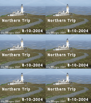
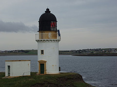
Fairly bright morning with the odd spot of rain. No tropical cyclones to report on, not even embryonic ones. So, up goes the big green notice on the TC blog: no updates until this situation changes.
I have to agree with Madeleine McCann's parents that the media speculation on little Madeleine's fate and whereabouts is going over the top and should stop. This week alone, I saw theories vented on the front pages of the tabloids, varying from accident to poison. On the other hand, they have raised this spectre of media hyperattention themselves, in their hour of despair, but are finding it difficult to control now.
PLEASE RELAY BELOW ITEM
I repeat my warning from earlier in the week that monster.com has been hacked. If you have personal details logged on that site, they have fallen into the hands of spammers. These details include names, addresses and telephone numbers. About 1.3 million people are thought to be affected. Please be careful if you have registered with that site, and start to see plausible looking emails from a recruitment site: it may be a phishing scam. The general advice is not to log too many personal details on-line.
Saturday, 25 August 2007

Friday, 24 August 2007
Mountain expedition
Just wanted to share a mountain ascent I did in Harris. I did several, but not all with pictures. Harris' mountains go up to 799 metres, that's a smidgen over 2,600 feet. I reached 690 metres on a hill called Teileasbhal, until a sense of exposure forbade me from proceeding further. I'm not happy with a gulf of 1,500 feet beside me. I've featured this entry before, but just wanted to share this crazy day again.

Teileasbhal - 19/04/05
Nice start to the day weatherwise, and jump on the Harris bus to Bogha Glas. Thought busdriver knew where I want off, he has dropped off by the Bardon site office before. No, he had to be told. Went up the track to Glen Langadale and branched left at the cairn, to go down to the upstream ford. Bit soggy underfoot going downhill. Have a camera with me, so I’m snapping away. Found the mapcase lying where I left it accidentally on Saturday, none the worse for its 3 nights and days in the open. Tackle that messy ascent towards the pass between Stuabhal and Stulabhal between 12 and 12.45. I take a different route every time, but it remains steep and soggy. Once on the pass, I continue uphill to Creag Stulabhal, a fairly straightforward climb up a grassy incline. Once up there, I follow the edge of the crag at a safe distance – it plummets down 300 m (1,000 ft) over just 100 m. There is one very eerie viewpoint down to Loch Stuladail. The view continues to expand upon reaching the highest point of the Creag at 513 m (1680 ft). It’s a bright sunny day with a fresh wind, and temperature at a very pleasant 15C (60 F). From the Creag, the shoulder falls away to Sron Ard, southeast of Loch Bhoisimid. Can look all the way to Kinloch Resort, Morsgail and Great Bernera. In a flurry of confidence, I decide to tackle the next summit, Teileasbhal. This is a fair walk of about 1½ miles and 184 m ascent (600 ft). It’s easy going round Coire Sgurra –breac, but boulders and stone slabs start to pop up. The grass is flattened down in places, as if there has been recent snow. The way is easy to find and there is room to divert around the nastier outcrops. Meanwhile, the altitude gained begins to dwarf everything around. I stop my ascent of the mountain some 100 yards short (about 15 m vertically) of the summit, which is at 697 m (2,290 ft). Proceeding further would have meant an uncomfortable sense of exposure. This is an acute awareness of your height, and the precipitous drops nearby. Furthermore, the actual summit is very rocky. It’s 13.45, and I’m in serious mountain terrain now. The drop into the adjacent valley, to the east, is 470 m (1,540 ft); I’m well above Mullach an Langa (614 m = 2,014 ft) across the valley. To the southwest, an even higher summit can be reached by traversing a very exposed looking ridge to Uisgneabhal Mor (729 m = 2,390 ft). This is the southeastern end of a nasty-looking ridge toSron Scourst, which towers 491 m (1,600 ft) above the valley leading north from Miabhaig. Only a few places are higher than me now; Uisgneabhal Mor, Mulla fo-Thuath (720 m = 2,362 ft), Mulla fo-Dheas (743 m = 2437 ft) and Clisham (799 m = 2,620 ft), the highest peak in the Outer Hebrides. These four peaks look forbiddingly precipitous, and I’d be very ill at ease on them. The view is unforgettable, virtually 360°. South: Taransay, Ceapabhal and Sodhaigh Beag + Mor, as well as the hills on North Uist and Benbecula. Loch Resort pops up in several places. In the bright sunshine, the house at Kinloch Resort stands out clearly, as does Morsgail Lodge. Can see Loch Roag and Bearnaraigh Beag; hazy on the northern horizon stands Muirneag near Tolsta, more than 25 miles away, and can discern the vague outline of the Barvas Hills. Can see the ferry leaving Stornoway Harbour at 1.45. Close by, Glen Langadale next to Stuabhal; Loch Langabhat curves northeast towards a very diminutive looking Roineabhal. Across the hills to the east of the loch, Loch Seaforth and Seaforth Island stand out in the sun. The mountains on the mainland march on the eastern horizon, 50 miles and more away. Skye is visible to the southeast. A view to put in your pocket and take home. Just before 2 pm, I start my descent. Have a little bother with some of the slabs, but again, I have room for a diversion or two. Walk round the corrie towards Stulabhal, then down the hill to the pass and down that horrible stretch by Gil Slipir. I dislike that boggy, slippery, stoney and steep bit. OK, return to Langadale River at 3.30. It’s so warm, incredible. Wade across the river, then go a little way up the path barefoot. Not bad, except I sink ankledeep into all the bogs. Washthe feet in a stream, then press myself hard to the road. No lunch today, incidentally, but did treat myself to marsbars and apples. Bus arrives at 5.05 to take me back [...]. Am well sunburned, and have taken off the waterproof overtrousers. This naturally results in my trousers getting very dirty indeed.
Teileasbhal - 19/04/05
Nice start to the day weatherwise, and jump on the Harris bus to Bogha Glas. Thought busdriver knew where I want off, he has dropped off by the Bardon site office before. No, he had to be told. Went up the track to Glen Langadale and branched left at the cairn, to go down to the upstream ford. Bit soggy underfoot going downhill. Have a camera with me, so I’m snapping away. Found the mapcase lying where I left it accidentally on Saturday, none the worse for its 3 nights and days in the open. Tackle that messy ascent towards the pass between Stuabhal and Stulabhal between 12 and 12.45. I take a different route every time, but it remains steep and soggy. Once on the pass, I continue uphill to Creag Stulabhal, a fairly straightforward climb up a grassy incline. Once up there, I follow the edge of the crag at a safe distance – it plummets down 300 m (1,000 ft) over just 100 m. There is one very eerie viewpoint down to Loch Stuladail. The view continues to expand upon reaching the highest point of the Creag at 513 m (1680 ft). It’s a bright sunny day with a fresh wind, and temperature at a very pleasant 15C (60 F). From the Creag, the shoulder falls away to Sron Ard, southeast of Loch Bhoisimid. Can look all the way to Kinloch Resort, Morsgail and Great Bernera. In a flurry of confidence, I decide to tackle the next summit, Teileasbhal. This is a fair walk of about 1½ miles and 184 m ascent (600 ft). It’s easy going round Coire Sgurra –breac, but boulders and stone slabs start to pop up. The grass is flattened down in places, as if there has been recent snow. The way is easy to find and there is room to divert around the nastier outcrops. Meanwhile, the altitude gained begins to dwarf everything around. I stop my ascent of the mountain some 100 yards short (about 15 m vertically) of the summit, which is at 697 m (2,290 ft). Proceeding further would have meant an uncomfortable sense of exposure. This is an acute awareness of your height, and the precipitous drops nearby. Furthermore, the actual summit is very rocky. It’s 13.45, and I’m in serious mountain terrain now. The drop into the adjacent valley, to the east, is 470 m (1,540 ft); I’m well above Mullach an Langa (614 m = 2,014 ft) across the valley. To the southwest, an even higher summit can be reached by traversing a very exposed looking ridge to Uisgneabhal Mor (729 m = 2,390 ft). This is the southeastern end of a nasty-looking ridge toSron Scourst, which towers 491 m (1,600 ft) above the valley leading north from Miabhaig. Only a few places are higher than me now; Uisgneabhal Mor, Mulla fo-Thuath (720 m = 2,362 ft), Mulla fo-Dheas (743 m = 2437 ft) and Clisham (799 m = 2,620 ft), the highest peak in the Outer Hebrides. These four peaks look forbiddingly precipitous, and I’d be very ill at ease on them. The view is unforgettable, virtually 360°. South: Taransay, Ceapabhal and Sodhaigh Beag + Mor, as well as the hills on North Uist and Benbecula. Loch Resort pops up in several places. In the bright sunshine, the house at Kinloch Resort stands out clearly, as does Morsgail Lodge. Can see Loch Roag and Bearnaraigh Beag; hazy on the northern horizon stands Muirneag near Tolsta, more than 25 miles away, and can discern the vague outline of the Barvas Hills. Can see the ferry leaving Stornoway Harbour at 1.45. Close by, Glen Langadale next to Stuabhal; Loch Langabhat curves northeast towards a very diminutive looking Roineabhal. Across the hills to the east of the loch, Loch Seaforth and Seaforth Island stand out in the sun. The mountains on the mainland march on the eastern horizon, 50 miles and more away. Skye is visible to the southeast. A view to put in your pocket and take home. Just before 2 pm, I start my descent. Have a little bother with some of the slabs, but again, I have room for a diversion or two. Walk round the corrie towards Stulabhal, then down the hill to the pass and down that horrible stretch by Gil Slipir. I dislike that boggy, slippery, stoney and steep bit. OK, return to Langadale River at 3.30. It’s so warm, incredible. Wade across the river, then go a little way up the path barefoot. Not bad, except I sink ankledeep into all the bogs. Washthe feet in a stream, then press myself hard to the road. No lunch today, incidentally, but did treat myself to marsbars and apples. Bus arrives at 5.05 to take me back [...]. Am well sunburned, and have taken off the waterproof overtrousers. This naturally results in my trousers getting very dirty indeed.
Call for support
Please call by Gerry's journal Daughters of the Shadowmen. She is having major problems in her housing complex Westward Ho! One of the residents is an extremely violent character, who will stop at nothing. Gerry, who has had plenty to cope with in her younger years, now professes to be living in fear.
172 mph
That was the speed at which an Oxfordshire motorist was driving along the A420 road near the village of Kingston Bagpuize. That makes 277 kph in metric money. Even Hurricane Dean's winds didn't manage to blow that hard. The man in question was caught in a speedtrap and is due to be sentenced next month. For reference, this means that he was travelling at a rate of 77 metres (or 260 feet) per second. If you bear in mind that it takes the human body 1 second between registering an event and effecting a motoric response, you can well imagine that you're effectively not in control of your vehicle.
No Celebrity Big Brother in 2008
At last, sense is permeating the high echelons of Channel 4. The Celebrity edition of that excruciating piece of television called Big Brother has been axed for 2008. This comes in the wake of the alleged racism rows on the last CBB show, at the start of this year. It is not so much the alleged racism as the unplumbable depths to which this program has crashed that has put me against it. I hope they axe the format altogether. They don't know what to do next to keep it alive. Pull the plug, Channel 4.
Wilderness treks - II
The second walk in the area of the 1875 map took place on May 17th, 2005, and covered ground to the west of Grimersta.
Scaliscro & Morsgail - 17/05/05
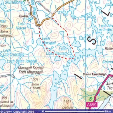
Head out to the Scaliscro road end, along the Uig road, 2 miles east of Morsgail. Set off on walk at 12.45; along the B8011 for a few hundred yards then it's off on an all-terrain vehicle track. This leads along a non-descript valley. The trail is pretty much dried out at the moment, but could well be a veritable bog after heavy rain. The way climbs gradually past Loch Ruadh / Red Loch. The view opens out before me. When I reach the highest point at 90 metres (300 ft), at GR 175232, there is a choice of routes. I can traverse the valley west, and cut along the northern bank of Loch Coire Geurad, head east along the slopes of the hills towards Roineabhal or continue south towards Loch Bruaiche Breibhat and Loch Coire Geurad. I opt for the last route and carry on down the ATV trail. The view is clear along the length of Loch Langabhat. From Roineabhal south, I can see all the hills along the loch's eastern shore, and some of the Eishken hills beyond. The track from Aline can be seen snaking its way down below Creag na Clibhe. The highest summits between Clisham and Stuabhal are wreathed in rainclouds. It almost looks as if there is snow on the summit of Stuabhal, but the temperature (9C) is just too high for that. Coltraiseal Mor blocks off the view due west. I carry on downhill and presently am on the strip of land between Loch Bruaiche Breibhat and Loch Coire Geurad. The ground is broken in places, but there are no major problems with bogs. I lost the trail in place, and blaze my own. Regain the ATV track beside Cul Laimhe Mor. There are a few sandy beaches at the southern end of Loch Coire Geurad. To the east, I can now see Ciorabhal. At about 2.30, I jump over the outflow of the loch and reach the Stornoway Angling Association hut. There are two boats (SAA1 and 2) tied up. The door is triple locked. Just as I finish a late lunch, at 2.45, the rain starts. So I pack up and head west over the hills. After half an hour, I reach Loch Lomhain, a bit further south than I'd hoped. However, it's easy walking on the grassy if bumpy slopes of Ascleit. Now heading northwest along the shore of the loch, then up the hill of Druim Lomhainn. On the far side, Scalabhal Mula rears up to the left, and Coltraiseal Mor faces me broad side on. I aim for a point to the left of Loch Ruidh a Dheas, with Loch Ruidh Meadhanach far right. It's broken ground, but not too horrendous. On reaching the Oscaroe River, I can see straight out to Loch Roag, 2 miles to the north. I decide to cross the river, and pick up the Morsgail trail. It's boggy on the ridge of Liana Ban Mas Scalabhal (that's one name...). Head to the right of Loch Ruadh mas Scalabhal, and to the left of a nameless body of water. After a short teabreak on the ridge, just before 4 pm, I head down to and onto the Morsgail trail, and I reach the road at 4.15. Proceed to the gate by the rundown croft, and decide to take the ¼ mile shortcut to the main road. Find a sheep that has sunk into a bog by its 4 feet. The smell indicates to me that it is dead. It's just standing there with eyes open. Very unpleasant. Traverse a boggy meadow, which sometimes houses sheep. Today, there is not a cow and not a (live) sheep in sight. Except out on the road, but that's another story. Arrive there at 4.50
Scaliscro & Morsgail - 17/05/05
Head out to the Scaliscro road end, along the Uig road, 2 miles east of Morsgail. Set off on walk at 12.45; along the B8011 for a few hundred yards then it's off on an all-terrain vehicle track. This leads along a non-descript valley. The trail is pretty much dried out at the moment, but could well be a veritable bog after heavy rain. The way climbs gradually past Loch Ruadh / Red Loch. The view opens out before me. When I reach the highest point at 90 metres (300 ft), at GR 175232, there is a choice of routes. I can traverse the valley west, and cut along the northern bank of Loch Coire Geurad, head east along the slopes of the hills towards Roineabhal or continue south towards Loch Bruaiche Breibhat and Loch Coire Geurad. I opt for the last route and carry on down the ATV trail. The view is clear along the length of Loch Langabhat. From Roineabhal south, I can see all the hills along the loch's eastern shore, and some of the Eishken hills beyond. The track from Aline can be seen snaking its way down below Creag na Clibhe. The highest summits between Clisham and Stuabhal are wreathed in rainclouds. It almost looks as if there is snow on the summit of Stuabhal, but the temperature (9C) is just too high for that. Coltraiseal Mor blocks off the view due west. I carry on downhill and presently am on the strip of land between Loch Bruaiche Breibhat and Loch Coire Geurad. The ground is broken in places, but there are no major problems with bogs. I lost the trail in place, and blaze my own. Regain the ATV track beside Cul Laimhe Mor. There are a few sandy beaches at the southern end of Loch Coire Geurad. To the east, I can now see Ciorabhal. At about 2.30, I jump over the outflow of the loch and reach the Stornoway Angling Association hut. There are two boats (SAA1 and 2) tied up. The door is triple locked. Just as I finish a late lunch, at 2.45, the rain starts. So I pack up and head west over the hills. After half an hour, I reach Loch Lomhain, a bit further south than I'd hoped. However, it's easy walking on the grassy if bumpy slopes of Ascleit. Now heading northwest along the shore of the loch, then up the hill of Druim Lomhainn. On the far side, Scalabhal Mula rears up to the left, and Coltraiseal Mor faces me broad side on. I aim for a point to the left of Loch Ruidh a Dheas, with Loch Ruidh Meadhanach far right. It's broken ground, but not too horrendous. On reaching the Oscaroe River, I can see straight out to Loch Roag, 2 miles to the north. I decide to cross the river, and pick up the Morsgail trail. It's boggy on the ridge of Liana Ban Mas Scalabhal (that's one name...). Head to the right of Loch Ruadh mas Scalabhal, and to the left of a nameless body of water. After a short teabreak on the ridge, just before 4 pm, I head down to and onto the Morsgail trail, and I reach the road at 4.15. Proceed to the gate by the rundown croft, and decide to take the ¼ mile shortcut to the main road. Find a sheep that has sunk into a bog by its 4 feet. The smell indicates to me that it is dead. It's just standing there with eyes open. Very unpleasant. Traverse a boggy meadow, which sometimes houses sheep. Today, there is not a cow and not a (live) sheep in sight. Except out on the road, but that's another story. Arrive there at 4.50
Wilderness treks
The map I featured earlier today covers an area that I have explored on foot more than 2 years ago. I went in twice within one week. The 15 pictures above were taken on May 13th, 2005, and I copy the relevant part of the journal entry below.
Bernera Road End to Balallan - 13/05/05

Friday the 13th is not an auspicious day, but I nonetheless go out for a major expedition. It’s sunny and warm today. So, I jump on the Uig postbus and alight at Bernera junction, 4 miles west of Garynahine. From there I have to walk 1 km southwest along the main road. A sheep has been knocked down and killed, with its bloody remains adorning the roadside. Yuk. At gridreference 198282, I head south on a track that will take me along the western shore of the string of lochs which drain Loch Langabhat to the sea. First is Loch Faoghail an Tuim. After half a mile, a house appears which is built on a small island. The causeway leading up to it is partially submerged. A green boathouse ¼ mile further up stands at the end of the hard track. There is a fair trail going further south. Loch Faoghail Charrasan accompanies me for the next mile. Only low hills on the far shore, but they hide a veritable maze of lochs and waterways. I find another bothy, all locked up. It’s got bunkbeds inside, but it looks a bit untidy. Who would use these, I wonder. There is a succession of jetties along the western shore; the eastern side is completely derelict. Behind the bothy, I clamber over a low ridge and head west for the second promontory, which juts out to separate Loch an Easa Ghil and Loch Faoghail Chiorabhal. Have to negotiate an area which would be soppy in wet weather. Bearing as far southeast as possible, I reach an awkward succession of stepping stones which I do have to negotiate in order to avoid a massive detour west. Do have to take boots and socks off to take an extra step in the water. Once safely on the far side, I continue to another bothy by a jetty. As I stand there, I look at the churning water in the channel beside me. It whips itself into a swishing, hissing circle and this circle moves inland. A tornado! The heather and grasses flail about in the wind, then the phenomenon dissipates up the hillside. Very strange. It is very warm in the sun, with some cumulus clouds, and the combination of water and turbulence could have created this little vortex. Continue down the track to the far jetty under the shadow of Coirabhal, on the far shore. Small cairns mark the channel. Ròineabhal looms up ahead, as it has done right the way through. A boat lies at the end of the track, completely filled with water. I could have taken it after bailing it out, but that would not have been right. I now disappear into the trackless wilderness along Loch Airighna h-Airde. It’s just over 2 km or 1½ miles to the fords at Eilean Mor. The mountains in North Harris pop up over the ridges of the hills to the southwest, Stuabhal most conspicuous. I follow the shoreline dutifully and presently draw level with Eilean Mhic Fail, a dark hump of an island. Finally, at 3.15, the loch narrows to the western outflow channel of Loch Langabhat. I have to cross this, and it’s a hell of a job. Deep, cold and fast flowing water, stones you cannot stand on as they’re too slippery. After that, I have another ford to negotiate on the far side of the island. Head north of its highest point towards the other channel. The spot marked ford on the map is unsuitable. The water is deep and fast flowing, the rocks are slippery and there are no handle holds. I scout downstream and presently find a more suitable location, shallow water, small stones, not slippery. But cold. On the far bank, I take a 60 minute break from 3.50. I do that because the bus from Balallan leaves at 7.40, and it’ll take me just over 1½ hours to reach that village from this point. It’s pleasantly warm in the sun, up to 22C! Finally I pack up at 4.50 and head east northeast towards Loch Ihagan, then veer southeast in order to avoid Loch Ròineabhal. It’s a bad idea to use Trealabhal as an aiming point; this hill is surrounded by water. Near the shore of Loch Ròineabhal, I aim for a valley just off the hill itself and settle into a long trudge. At the height of the pass, I glance back. Can see a car on the Great Bernera road, 5 miles north. Callanish and Breascleit stand out in the evening sun. Head east from here and make for Balallan. About half an hour away from the village, I take another 60 minute break, again in the blazing sunshine. Although it is quite late now, it’s still pleasant. Watch the traffic on the A859, beyond Loch Stranndabhat. At 7pm, I resume my return to civilization. Encounter some men working cattle. Have to wait until 7.50 for thebus to turn up; the South Lochs bus first has to go to Airigh a’Bhruaich to pick up – nobody. I’m the only passenger on board.
Bernera Road End to Balallan - 13/05/05
Friday the 13th is not an auspicious day, but I nonetheless go out for a major expedition. It’s sunny and warm today. So, I jump on the Uig postbus and alight at Bernera junction, 4 miles west of Garynahine. From there I have to walk 1 km southwest along the main road. A sheep has been knocked down and killed, with its bloody remains adorning the roadside. Yuk. At gridreference 198282, I head south on a track that will take me along the western shore of the string of lochs which drain Loch Langabhat to the sea. First is Loch Faoghail an Tuim. After half a mile, a house appears which is built on a small island. The causeway leading up to it is partially submerged. A green boathouse ¼ mile further up stands at the end of the hard track. There is a fair trail going further south. Loch Faoghail Charrasan accompanies me for the next mile. Only low hills on the far shore, but they hide a veritable maze of lochs and waterways. I find another bothy, all locked up. It’s got bunkbeds inside, but it looks a bit untidy. Who would use these, I wonder. There is a succession of jetties along the western shore; the eastern side is completely derelict. Behind the bothy, I clamber over a low ridge and head west for the second promontory, which juts out to separate Loch an Easa Ghil and Loch Faoghail Chiorabhal. Have to negotiate an area which would be soppy in wet weather. Bearing as far southeast as possible, I reach an awkward succession of stepping stones which I do have to negotiate in order to avoid a massive detour west. Do have to take boots and socks off to take an extra step in the water. Once safely on the far side, I continue to another bothy by a jetty. As I stand there, I look at the churning water in the channel beside me. It whips itself into a swishing, hissing circle and this circle moves inland. A tornado! The heather and grasses flail about in the wind, then the phenomenon dissipates up the hillside. Very strange. It is very warm in the sun, with some cumulus clouds, and the combination of water and turbulence could have created this little vortex. Continue down the track to the far jetty under the shadow of Coirabhal, on the far shore. Small cairns mark the channel. Ròineabhal looms up ahead, as it has done right the way through. A boat lies at the end of the track, completely filled with water. I could have taken it after bailing it out, but that would not have been right. I now disappear into the trackless wilderness along Loch Airighna h-Airde. It’s just over 2 km or 1½ miles to the fords at Eilean Mor. The mountains in North Harris pop up over the ridges of the hills to the southwest, Stuabhal most conspicuous. I follow the shoreline dutifully and presently draw level with Eilean Mhic Fail, a dark hump of an island. Finally, at 3.15, the loch narrows to the western outflow channel of Loch Langabhat. I have to cross this, and it’s a hell of a job. Deep, cold and fast flowing water, stones you cannot stand on as they’re too slippery. After that, I have another ford to negotiate on the far side of the island. Head north of its highest point towards the other channel. The spot marked ford on the map is unsuitable. The water is deep and fast flowing, the rocks are slippery and there are no handle holds. I scout downstream and presently find a more suitable location, shallow water, small stones, not slippery. But cold. On the far bank, I take a 60 minute break from 3.50. I do that because the bus from Balallan leaves at 7.40, and it’ll take me just over 1½ hours to reach that village from this point. It’s pleasantly warm in the sun, up to 22C! Finally I pack up at 4.50 and head east northeast towards Loch Ihagan, then veer southeast in order to avoid Loch Ròineabhal. It’s a bad idea to use Trealabhal as an aiming point; this hill is surrounded by water. Near the shore of Loch Ròineabhal, I aim for a valley just off the hill itself and settle into a long trudge. At the height of the pass, I glance back. Can see a car on the Great Bernera road, 5 miles north. Callanish and Breascleit stand out in the evening sun. Head east from here and make for Balallan. About half an hour away from the village, I take another 60 minute break, again in the blazing sunshine. Although it is quite late now, it’s still pleasant. Watch the traffic on the A859, beyond Loch Stranndabhat. At 7pm, I resume my return to civilization. Encounter some men working cattle. Have to wait until 7.50 for thebus to turn up; the South Lochs bus first has to go to Airigh a’Bhruaich to pick up – nobody. I’m the only passenger on board.
Broadband speed
Are you on broadband? Fed up with not getting the advertised download speed? Check your broadband speeds with this nifty site. I am supposed to get 7.6MB/s download, but in actual fact it was no better than 1.9MB/s. Now, I am 700 miles from my ISP, so things will drag a bit. At least it's better than one poor soul in the Western Isles who is down to snail's pace at 15kB/s.
Map - enlarged
 This is an enlarged and high-quality version of the image of the old map which I showed in my previous entry. Off to a bowl of chicken & curry soup.
Map


Yesterday, I mentioned the old map pertaining to fishing rights. I photographed it, and the historically relevant sections. James Matheson was the owner of Lewis in the 1870s. The Grimersta Estate, located between Loch Langabhat and Loch Roag, is to this day a fishing and shooting area where hardly anyone lives. Only the villages of Crulivig, Iarshader and Lundal are there. I intend to find out more about this map if I can.
Close of week
TGIF, after an exciting week on the weather front. Hurricane Dean is no more, only a disorganised cluster of showers just west of Baja California in northwestern Mexico. Here in the islands, it's a blustery day with occasional showers and low clouds. I just caught sight of a French trawler leaving port after their fortnightly 90 minute crew change.
 Read a disturbing item on BBC News about the threat of a global epidemic, and I'm not just talking birdflu. Cholera, TB, malaria, ebola, AIDS... need I go on? There are strong reasons for these disease to spread rapidly and widely - think airtravel. Also, poor hygiene precautions, war, natural disasters and the like. It requires international cooperation to curb these outbreaks, and it's precisely that what is lacking.
Read a disturbing item on BBC News about the threat of a global epidemic, and I'm not just talking birdflu. Cholera, TB, malaria, ebola, AIDS... need I go on? There are strong reasons for these disease to spread rapidly and widely - think airtravel. Also, poor hygiene precautions, war, natural disasters and the like. It requires international cooperation to curb these outbreaks, and it's precisely that what is lacking. Close of day

It's after midnight, and time for me to shut up shop. But not before this.
With the 4th anniversary being such a low-key affair, a few things have fallen by the wayside, I feel. Although now 3 days ago, I think we should not forget those among us who have gone ahead - as it used to say in my old church parish magazine. For these past 12 months, that applies to (amongst many others) Jim Halliday, who wrote No Sundays, the Memoirs of a Teenage Killer. Paul (plittle, Aurora Walking Vacation) left a comment in John Scalzi's journal that he still missed Pamela (his1desire), who passed away on Easter Sunday 2006. Pam, like John, had been there from the start of AOL Journals, and I think it is fitting that she be remembered this week.
Neither should we forget those among us, or in our immediate circle, who are ill in body or in mind. I never cease to be horrified at the decrepit level of health care that is awarded to those in the United States who are not in the money. Several J-landers are suffering more than necessary as a result. My sidebar contains a handful of graphics dedicated to those referred to in the first sentence of this paragraph.
Finally, Sugar did a splendid job last year in compiling a Memorial for J-land pets. Several amongst us have seen companions pass over the Rainbow Bridge this year. Please revisit the Memorial.
Bumper sticker
Weekend assignment #180 by John M. Scalzi - I'm not a regular follower, but this appealed to me.
Go to this bumpersticker generator and make a bumpersticker. Then post it in our journal. Here is mine.

Go to this bumpersticker generator and make a bumpersticker. Then post it in our journal. Here is mine.
Three years ago today
What went before...
After a few days in the Mallaig area, I relocated to the Western Isles on August 19th, to stay in Stornoway for one night. On Friday morning (August 20), I embarked on the 125 mile journey to Castlebay, Isle of Barra. Having spent an excruciating weekend on the most uncomfortable bicycle known to man, I was now wending my way back north, to Lewis.
I do not have pictures available of this trip.
Barra to Tarbert - 23/08/04
Breakfast was early, at 7.45, as I have been offered a lift with the man of the house who is driving an articulated lorry to Eriskay this morning. It's a huge vehicle, which has to go through an incredible number of gear-changes before it reaches something like a normal cruising speed. We leave at 8.30, and I'm surprised how nimbly the truck negotiates the narrow island roads. We're bang on time for the ferry at Ardmhor. The crossing, in a force 5 wind, is pretty lively. The lorry is shackled to the deck. Forty minutes later, we dock at Eriskay. I thank the driver and jump on the bus that's standing ready at the quayside, waiting to depart for Balivanich. The route goes over the Eriskay causeway to Ludag, Polachar Inn, Garynamonie and Daliburgh. At the Howmore Garage, we wait for a wee while, before continuing north. Have to change buses at Balivanich Airport. As I still have time, I nip inside to grab some sandwiches from a cafeteria. Meanwhile, I have coverage on my mobile for the first time since Friday, so the texts start flooding in. Finally, the bus arrives and I continue my journey north, via Grimsay to North Uist. The 13.30 ferry takes me from Berneray to Harris, under a grey sky. On arrival at Leverburgh, the Hebridean Transport coach is waiting, but we're not going for another half hour. When we do go at 3 pm, the bus turns into a sight-seeing tour, for the benefit of people who are doing a triangular trip with Calmac. We stop on the hill above Northton to allow tourists to take pictures of Northton beach. We stop at one beach, further up the road, for about 20 minutes. Everybody gets off to clamber down to the sandy shore, and walk almost as far as MacGregor's Stone, set on a hill off the far side of the beach. Our attention is drawn to good old Taransay and the Golden Road. Arrive into Tarbert just before 4pm. I decide to settle down for the night here. If I carry on to Stornoway, I may not be on time at the TIC to help me out with a bed. Arrival time there 5 pm. So, I make my way to the McLeod Motel, which offers me B&B for £28. Pokey little room with an iffy telly. WC and showers are shared with about 10 rooms. I go out for a walk up the Scalpay road, as far as the first sign for Urgha, past the junkyard. Retrace my steps into the village and ask for the library, which is located on a school's premises. This turns out to be a new building. Later on, I have a meal in the bar adjacent to the motel. Total lack of atmosphere in the bar,which is in common with the motel. Food acceptable. Have a nice chat with an Aussie lady who is working her way round the UK, waitressing. Her boyfriend does likewise. We compare notes on the Scottish experience.
After a few days in the Mallaig area, I relocated to the Western Isles on August 19th, to stay in Stornoway for one night. On Friday morning (August 20), I embarked on the 125 mile journey to Castlebay, Isle of Barra. Having spent an excruciating weekend on the most uncomfortable bicycle known to man, I was now wending my way back north, to Lewis.
I do not have pictures available of this trip.
Barra to Tarbert - 23/08/04
Breakfast was early, at 7.45, as I have been offered a lift with the man of the house who is driving an articulated lorry to Eriskay this morning. It's a huge vehicle, which has to go through an incredible number of gear-changes before it reaches something like a normal cruising speed. We leave at 8.30, and I'm surprised how nimbly the truck negotiates the narrow island roads. We're bang on time for the ferry at Ardmhor. The crossing, in a force 5 wind, is pretty lively. The lorry is shackled to the deck. Forty minutes later, we dock at Eriskay. I thank the driver and jump on the bus that's standing ready at the quayside, waiting to depart for Balivanich. The route goes over the Eriskay causeway to Ludag, Polachar Inn, Garynamonie and Daliburgh. At the Howmore Garage, we wait for a wee while, before continuing north. Have to change buses at Balivanich Airport. As I still have time, I nip inside to grab some sandwiches from a cafeteria. Meanwhile, I have coverage on my mobile for the first time since Friday, so the texts start flooding in. Finally, the bus arrives and I continue my journey north, via Grimsay to North Uist. The 13.30 ferry takes me from Berneray to Harris, under a grey sky. On arrival at Leverburgh, the Hebridean Transport coach is waiting, but we're not going for another half hour. When we do go at 3 pm, the bus turns into a sight-seeing tour, for the benefit of people who are doing a triangular trip with Calmac. We stop on the hill above Northton to allow tourists to take pictures of Northton beach. We stop at one beach, further up the road, for about 20 minutes. Everybody gets off to clamber down to the sandy shore, and walk almost as far as MacGregor's Stone, set on a hill off the far side of the beach. Our attention is drawn to good old Taransay and the Golden Road. Arrive into Tarbert just before 4pm. I decide to settle down for the night here. If I carry on to Stornoway, I may not be on time at the TIC to help me out with a bed. Arrival time there 5 pm. So, I make my way to the McLeod Motel, which offers me B&B for £28. Pokey little room with an iffy telly. WC and showers are shared with about 10 rooms. I go out for a walk up the Scalpay road, as far as the first sign for Urgha, past the junkyard. Retrace my steps into the village and ask for the library, which is located on a school's premises. This turns out to be a new building. Later on, I have a meal in the bar adjacent to the motel. Total lack of atmosphere in the bar,which is in common with the motel. Food acceptable. Have a nice chat with an Aussie lady who is working her way round the UK, waitressing. Her boyfriend does likewise. We compare notes on the Scottish experience.
Thursday, 23 August 2007
Attitudes
As I said earlier, our weather has taken a turn for the worse. It does help to highlight different attitudes to the weather. Some people do not mind the weather - you don't come to the Hebrides for the weather. Others moan no end. I even remember a cyclist who had booked in, but rang in half an hour beforehand, saying he was going on the ferry to the mainland to be picked up by his wife. He was so wet and miserable, that he had abandoned the idea of cycling the remaining 25 miles to the Butt of Lewis (and back). Others wax lyrical, in spite of the rain. But when the sun does come out - it is even better.
Afternoon notes
AOL Webmail is down at the moment, am awaiting its resurrection. Weather has taken a turn for the worse, with mist and drizzle returning. It's not cold outside, went to the shops without a coat as I've been doing all week. 16C nearly constitutes a heatwave here.
It would appear that although hurricane Dean has left a trail of destruction behind, with several billion dollars' worth of damage, but relatively few fatalities. None in Mexico.
I was saddened to hear of the loss of lives in the American Mid-West following severe flooding, brought on by the remnants of tropical depression Erin. This system reinvigorated over land and dumped vast amounts of rain over states from Texas northeast to Ohio. Eleven are known to have died so far.
It would appear that although hurricane Dean has left a trail of destruction behind, with several billion dollars' worth of damage, but relatively few fatalities. None in Mexico.
I was saddened to hear of the loss of lives in the American Mid-West following severe flooding, brought on by the remnants of tropical depression Erin. This system reinvigorated over land and dumped vast amounts of rain over states from Texas northeast to Ohio. Eleven are known to have died so far.
Thursday notes
Fog disappeared after sunset last night, and it remains clear this morning. Cloudy, but with some brightness and a relatively mild 16C.
Found a map of 1875, showing an area for deerstalking and fishing in the island, which is used for that same purpose today, 132 years later. It shows that little has changed, apart from the size of the villages, the track of the roads and a bridge or two. I could conceivably use that map for walking in the centre of the island, if it wasn't for the small scale.
Hurricane Dean is no more - the National Hurricane Center issued its final (40th) advisory at 0300 GMT this morning. There is an outside chance that its remnant could regenerate in the Eastern Pacific in the next day or so. No other cyclones look set to form in the near future.
Found a map of 1875, showing an area for deerstalking and fishing in the island, which is used for that same purpose today, 132 years later. It shows that little has changed, apart from the size of the villages, the track of the roads and a bridge or two. I could conceivably use that map for walking in the centre of the island, if it wasn't for the small scale.
Hurricane Dean is no more - the National Hurricane Center issued its final (40th) advisory at 0300 GMT this morning. There is an outside chance that its remnant could regenerate in the Eastern Pacific in the next day or so. No other cyclones look set to form in the near future.
Wednesday, 22 August 2007

Evening notes
The sun set half an hour ago, and the fog has retreated to the edges of the Arnish Hills. When the ferry left for Ullapool at 7pm, it blasted its horn all the way out of port.
Still on the theme of weather, Hurricane Dean has made its final landfall in the Mexican province of Vera Cruz, with winds of 85 mph. The storm will move inland, dumping vast amounts of rain on the way before dissipation, within 24 hours. I repeat the heads-up that some of Dean's moisture may find its way into the southwestern United States. No other hurricanes are likely in the Atlantic, although a cyclone could form in the Western Pacific, south of Japan.
Closer to home, two human remains have been discovered amongst the ruins of the Penhallow Hotel in Newquay, Cornwall, which burned to the ground on Friday night. It would appear that they are those of a mother and son, both reported missing, presumed dead.
Still on the theme of weather, Hurricane Dean has made its final landfall in the Mexican province of Vera Cruz, with winds of 85 mph. The storm will move inland, dumping vast amounts of rain on the way before dissipation, within 24 hours. I repeat the heads-up that some of Dean's moisture may find its way into the southwestern United States. No other hurricanes are likely in the Atlantic, although a cyclone could form in the Western Pacific, south of Japan.
Closer to home, two human remains have been discovered amongst the ruins of the Penhallow Hotel in Newquay, Cornwall, which burned to the ground on Friday night. It would appear that they are those of a mother and son, both reported missing, presumed dead.
Fog
The fog continues to play and toy with us. A minister in the Scottish Executive was prevented from flying to Stornoway on account of it. The sun is out - but fog and low cloud continues to hover around the Arnish hills and the lighthouse. Above are shown some of the foggy imagery, taken earlier today.
Subscribe to:
Posts (Atom)