Thursday 30 September 2004

Aberdeen and Inverness - 30/09/04

For the first time in weeks, I had a room (or more accurately: a cabin)to myself. At 7 a.m., I found myself in a rain- and windswept Aberdeen.Delayed my departure from the ferry until the latest possible hour.Slouched off into the city at 10 a.m.. First thing needed: a town plan.Second: a post office, to send off maps and other stuff related toOrkney that was no longer required. A dark-coloured lady tried to chatme up in the PO, what a laff. Spent the rest of the morning slopinground the soaking-wet streets, with that bloody big pack on my back.Want to find the library, but Aberdeen, the Granite City, is very greyand even greyer in this rain. After I buy a pastry in a shop, andmiserably eat it on a bench, I locate the library. I walked past itseveral times during 40 minutes, just past the Robert GordonUniversity. No, the library wasn't that great either. Few terminals,very limited time, and the terminal I was on crashed. Went to thestation and found there was a train to Inverness at around 3pm. I wason it. Aberdeen I just do not like. Folk are friendly enough. Traindeparted at 3.25 and it was pretty full. As we went east, the rainrelented although it stayed overcast right the way through. I can't sayI'm riveted by the Moray or Aberdeenshire countryside - sorry, was in afoul mood all day that day. Arrived in Inverness at 5pm, and bookedinto the Youth Hostel on Millburn Drive. Then went back to the Safewaysfor shopping. Had a lot of bother finding my way round, I had becomequite used to the Co-op and Safeway stores in Kirkwall. Cooked supper,did the laundry, went on the Internet using vouchers. Fairly good deal:£1 for 20 minutes, or 24 minutes if you join the club. As membershipwas free, I gladly joined back in Kirkwall. Show a couple of younghostellers how to use the laundry machines. There is a group ofdisabled kids in who are on a trip out of Shetland. In Inverness, youcan only get into the rooms using a swipe card. Some strange charactersin my room tonight. Typical Mediterraneans, don't like them.

Wednesday 29 September 2004

Orkney Postscript

I have written these entries 11 months afterwards, so could not remember a lot about the individuals I encountered in the various dorms I occupied. Kirkwall YH had a washing machine, and a reasonable kitchen plus common room. There were two guys in my room at one time, who appeared to be best of friends, but when one left, he left behind the piece of paper with contact details and called his sleeping mate a very rude word. I spent many a morning helping overseas hostellers, from Japan and China, to choose an itinerary for their foray around Orkney.Later in September, our attention was drawn to travelling minibuses which take backpackers around Scotland in 7 days. On Tuesday, a minibus would roll up in the courtyard to disgorge a load of young folk, being shepherded by an exasperated older person. It was advisable to vacate the kitchen, as they were liable to leave a colossal mess behind. They were also told to go to bed on time. The following morning, they'd leave at 3 a.m. to catch the early morning ferry from Stromness. In Kirkwall, any food left behind had to be labelled and bagged before placing in pigeonholes. In the 3 weeks at Kirkwall, a crew of construction workers were billeted in the hostel. They were out to work on the airport runways - at night. The lady I met on Shapinsay would cook a meal for them to leave it out. Kirkwall has quite a nice town centre, and has everything you need.

Hoy - 29/09/04

In the morning, I jump on the bus to the Houton Ferry, to go to Hoy.Crossing was rendered uninteresting, because we were required to staybelow decks all the way to Lyness. On arrival, I have to time my walkcarefully. Lyness itself is just plain unsightly. It used to be part ofthe Scapa Flow naval base, and after the war the Royal Navy just pulledout and sailed off into the sunset. The base was just left to fall toruin. Worst are all the buildings, also scattered over the hillsidebeside the village. I walk north along the B9048, in the generaldirection of Moaness, at the northern end of Hoy. After about 45minutes, I have left the village and am in the farming area of theisland. Workmen are laying long stretches of blue piping, which I laterlearn are water mains. At 12.45, I reach a picnic site by Pegal Bay.This abuts a small, fenced-off nature reserve. All along this roadyou'll encounter milestones, totting up the distance between Lyness andMoaness. After Pegal Bay, the road veers inland to cross over theshoulder of Pegal Hill to Lyrawa Bay. Below Lyrawa Hill, 5½ miles / 9km outside Lyness, I encounter Betty Corrigal's grave. This is a recentfeature, a fibre-glass tombstone dedicated to the memory of a youngwoman who committed suicide after falling pregnant out of wedlock inthe 18th century. She fell for the charms of a sailor, who afterwardsdisappeared. She was buried in an unmarked grave, because suicides arenot buried in consecrated ground. She lay undisturbed for 160 years,until her coffin was found by peat cutters in 1930. Her body hadremained virtually intact, only the noose beside her had turned todust. She was reburied, but during WW2, sailors frequently got her out.Finally, in 1949, she was buried for the last time. An Americanminister asked for the current headstone to be erected, but this wasnot done for another 27 years. After a moment or two, I squelched myway back to the road. I walked up the track, onto the nearby LyrawaHill, to view the gun emplacements that lie abandoned there. Nice viewseast, towards Wideford Hill near Kirkwall, and the hills above Houton.At 2pm, I went back towards Lyness. Forty minutes later, I was verykindly offered a lift back to Lyness by an elderly Australian couplewho were here to trace ancestors by looking round graveyards. Their carmade short shrift of the remaining 4 miles, and I was left with 1½hours to kill around Lyness. Wandered up the hill to an ugly, derilict,concrete building that looked as if it had been some sort of HQ.Everything covered in layers of dirt, electrical wiring hanging allover. To escape the chilly north wind, I sat down in the lee of thebuilding for a cuppa. Then ambled down to the ferry terminal. Ferryarrived at 4pm, but they raised the ramp again. It's not due to sailuntil 4.40. Have a look round the Scapa Flow museum, and the hazardousdockside. Ferry leaves on time, and I'm having a pleasant chat with anice couple in their mid 50's. They offer me a lift back to Kirkwallonce at Houton. One other person joins me in the car, but not beforesomebody returns me a glove I had dropped somewhere. I'm dropped offoutside Safeways for shopping at 7pm. On return to the hostel, I decideto take the late ferry to Aberdeen. A quick taxiride at 10.30 dulydelivers me to Hatston, where the ferry lies docked. After about 10minutes, I'm allowed on board. Am shown to my cabin, where I take ashower, then retire for the night. The ferry sails at midnight, andexactly 4 weeks after arriving in Orkney, I'm leaving the islands. Theswell rocks me to sleep.

Tuesday 28 September 2004

On yer bike - 28/09/04

The weather has quietened down since Sunday's gale, and there is nowonly a gentle greeze. I go into town to hire a pushbike. At 11, Ipaddle down the Old Scapa Road after a preliminary circuit of the towncentre. This took me down Junction Road to the Orkney Ferries terminal,then along all sorts of back roads to the cathedral. At 11.10, I'mheading southwest along the A964 towards Orphir. It's a nice, sunny dayand make good progress. Consider a shortcut at Kirbister to Finstown,but don't like the prospect of hills. Have an interchange with atourist bus, all along the road to Scapa Garage. On arrival at HoutonTerminal, it's 12.30. It's a steep descent from the main road. Niceview across to Hoy. There are two piers here, one of which is theterminal for the ferry to Lyness, Hoy. Watch the world go by behind theferry office, then head off when the ferry comes in. By that time, I'vefinished lunch. Back up the hill to the main road, then left towardsBrig o'Waithe. The view opens out to Graemsay and Stromness, but it's along, long way to the A965, particularly with a headwind. Backside getssorer and sorer as I go along, but ** finally ** I gain the main road.Turn right and am now running the gauntlet of all the traffic. Pass thesideroad to the monuments, then stop off at a petrol station to buy anicecream and a coke. As I progress further east, the weather decidesit's warm enough for a shower. So, at the corner of the A986, I hide inthe busshelter to don my waterproofs. Reach Finstown without furthermishap. Here I decide to go to Kirkwall along the Old Finstown Road, ifonly to avoid the traffic. Well, I'm not very good at hills and thereis a lot of traffic on this road as well. Decide on a break a littleway west of Smerquoy Farm, but sitting in the verge of the road isn'tthat nice either. Get overtaken by a full schoolbus, and finally sailinto Kirkwall at 5pm. Blimey, wasn't I knackered. Return the bike tothe shop on Tankerness Lane, drop into the Internet Café across theroad. This is part of an IT training enterprise, which also servescoffee and snacks. Return to the hostel after shopping at Safeways.

Monday 27 September 2004

Inganess and Brough of Birsay - 27/09/04

For the morning session, I walk out at 10 o'clock, heading east out ofthe town centre towards Inganess Bay. This takes me along the road tothe B&B where I stayed nearly 3 weeks ago. Once past there, theroad veers off right; the road to Berstane Farm carries on straightahead. When I reach a wood, filled with junk, I am confronted with asign saying "Private", and I have to backtrack a little way. Then Ijump over a gate and head south along the perifery of the wood. Cancontinue along the fence for nearly a mile, with views opening up overthe airport. To my left lies the Creag of Berstane. Also see awindturbine near Heatheryquoy Farm. Cannot go there in a direct line,but have to veer right along fencing to Inganess Farm. Once on theminor road, I head east, downhill, to the salmon farm. I can drop downto the sands of Wideford, but have to rejoin the top of the seawallafter the salmon farm. From here, a new-looking signposted walk leadsme back to Scapa. The route is punctuated by some horrendously steepstiles, but finally I arrive at the A960 road to the airport. Crossthis with care and carry on along the path. With some difficulties inorienteering, I reach the A961 Burwick road at midday. Cross with careand head into the road that leads to and past Fea Farm. From here, thetrack winds itself down a messy looking slope to Scapa Pier. This isfamiliar territory and I easily walk back to the YH on Old Scapa Road.After lunch, I join the bus which will take me to the Bishop's Palaceand nearby Brough of Birsay (on the far northwestern corner of OrkneyMainland). The bus goes past Finstown, then down the A986 along suchplaces as Doune and Twatt. People alight at various places along theway, some of them quite jolly. Many have been into town to do theirshopping, and are now lumbering it home. Reach Birsay at 2.30. A fewpeople get off here, several joining the bus for the journey back toKirkwall. First of all, I have a look inside the small church dedicatedto St Magnus. A little bare - have a look at this link http://www.birsay.org.uk/stmagnus.htm.
Also have a look inside the ruined Earl's Palace, of which only a fewfeet now remain of its walls. In every room, a little note tells thestory about it. Having walked through the ruins, I finally make my wayto the Brough. This lies about a mile west of Birsay village and is atidal island, only accessible at low tide. A concrete slabbed walkwayprovides a fairly safe if slippery access route. On arrival at theother side, I say hello to the warden and start by looking round theViking settlement, of which only foot-high walls remain. It included achurch. Then I go on a walk around the island, which has some prettyhigh seacliffs, up to 40 metres / 135 ft high. Like the views down thecoast to Marwick Head, with cliffs up to 80 metres / 265 ft high. Passthe lighthouse, where a cleft, only a few inches wide, crashes down tosealevel. The coastline is eroding badly, and you have to be verycautious. I walk along, latterly with two other people in the distance.Cross the causeway back to the mainland at 4pm, and stay behind towatch the tide coming in. Have a little walk along the coastline toSkipi Geo, where people used to store their boats high up on the shore,in a shed. Sit down with two other walkers to enjoy the afternoon sunfor a while. Then head back to the carpark to watch the tide creep in.At 4.30, the flag is taken down at the visitor centre on the Brough,and the warden cross over. Shortly afterwards, the tide covers themiddle section of the walkway. We had a cup of tea from a van sellingsausage rolls, but when we looked round again, it had gone. Hobble backto the village to wait for the 6pm bus. It's a long and chilly wait.The return journey goes along the north coast of Mainland to Evie andLoch of Swannay. Pick up ferry passengers at Tingwall and return toKirkwall at 6.50

Sunday 26 September 2004

Sunday 26/09/04

It's a cloudy day today, and it does not look as if it's going tobrighten up. Arrive at a derilict busstation to take the tourist bus toSkara Brae, with a view to walk across to Stromness. It's also quiteblustery and cold. Alight at the neolithic village at 11, and now havethe rest of the afternoon to cover the 6 miles to Stromness. I startoff by merrily walking into the teeth of the gale, past Skaill Farm,along walls and through pastures. Past herds of bemused looking cows,but very quickly I find myself crossing barbed-wire fences without anystiles. Back I go, glad to have my face out of that very cold SW wind.Retrace my steps as far as Skaill Farm, then head southeast, along afarmtrack that runs roughly past Loch Skaill. Then it's due south, andI'm again diverted because of herds of cows. WIth difficulty, onaccount of an overgrown and boggy farmtrack, I gain the road whichleads south to Stromness. Because of the force 8-9 wind, I decide toengage in a spot of roadwalking. This presents me with quite achallenge, because the severe gale strength wind is determined to blowme into the path of oncoming traffic. After 2 miles, I get theopportunity to leave the busy B9050/A967 to briefly head for quieterside-roads. Pass Kirbister and proceed over Redland Hill. Here,a minordisaster befalls me, in that one of my bootlaces breaks. I tie the twoends together and carry on. My mapcase is also giving me grief. Thisconsists of a Morrisons bag, and is flapping furiously, not reallyaffording much protection against the force 9 winds. Carry on along theA967, with the weather improving gradually. As I struggle past Newburghand Millhouse, the sun comes out. Head into a country lane to enterStromness by the backdoor. The ruinous farm buildings along here don'tdo much for the scenery. Take a break off Millhouse farm, then descendto the bridge cum ford across the Mill Burn and wearily trudge down thehill into Stromness proper. This is along HIllside Road, not the mainKirkwall Road. Past the Co-op and the firestation at 4pm, and upFranklin Road to gain the higher reaches of Stromness. Even go upBrinkies Brae with my purchases from the Co-op, then into the town fora cuppa before the bus comes back at 4.50. Julia's Cafe is a nice weeplace opposite the ferry terminal. Kids are sliding along the tiledfloors. Have a cup of tea and a pastry before I rejoin the bus back toKirkwall. Sun is out on the way back, making it quite an acceptablelate afternoon.

Saturday 25 September 2004

Wideford Hill towards Orphir - 25/09/04

Today is a day of changeable weather, with occasional showers. Notdaunted by that, I head off down the Old Finstown Road. It runsparallel to the A965 Kirkwall to Stromness road, but to the southof Wideford Hill. This hill has transmitters on its summit. TheOld Finstown Road is fairly busy, and I'm in the verge quitefrequently. About 3 miles outside Kirkwall, a road goes up the hilltowards the summit of Wideford Hill. The road passes through a load ofmuck outside Heathfield Farm. After ¼ mile and 140 m of ascent, theroad veers sharply left. Nice views here over Scapa Flow. Finalllyarrive on the summit, where the wind blows hard. A shower comesclattering by. Reasonable views, impeded by shower clouds. Can justabout discern Rousay and Westray. Islands to the northeast are obscuredby showers. Can see Duncansby Head on the Scottish mainland to thesoutheast. A plaque near the summit cairn announces that Lerwick is 105miles away to the northeast. Proceed downhill along a track that leadsnorthwest. I leave it to go sharply downhill to Smerquoy Farm. Thensystem of fencing means that I end up in a prickly situation, but Imanage to cross the barbed wire fence. Smerquoy Farm has a duckpond.Once on the main road, I wander up and down the decide to gain thehills in the interior through Lesliedale Farm. I'm probablytrespassing, but am not molested by dogs or owner. Follow a broadfarmtrack, which offers tantalizing views of Burrey Brae Hill. Electricfencing prevents me from going there, and I end up walking back towardsKirkwall for 1 km. Then I become bold and wallow through some mud to afield full of over-friendly cows. I scramble over a wall to escape fromthe creatures and make my way uphill. As I finally crest Burrey Brae,the dark cloud of a shower approaches from the west. The transmitterson the top of Keelylang beckon, but I am unable to reach them. Thereason? Electric fencing. In a heavy downpour, which is actuallyblinding me with stinging rain, I proceed to a junction in the fencingand am forced downhill, to the south. Had I been able to go toKeelylang, I would have gone on to Finstown. Now, I make my way south,through some very tough heathery moorland. The fence accompanies me onthe way, finally petering out near a sheepfarm at Loch of Kirbister. Iam delighted to reach a tarmacked road at a pier on the loch. A bus isdue for Kirkwall at 6 pm. It's now only 5 o'clock, so I hobble slowlyup the road towards Kirkwall. Have a look at the nature reserve atHobbister - not interesting. Entertain myself with cattle and sheepalong the way, when the bus come in the opposite direction. Sit down towait for it to reverse at Orphir, then it carries me back to the YouthHostel along the Old Scapa Road. The showers have relented by now.

Friday 24 September 2004

Papa Westray revisited - 24/09/04

Went on another visit to Papa Westray today. Left on the ferry at12.30, which was advertised as going to Papay. However, due to theinclement conditions out at sea, the boat would only go as far asWestray. I insissted I was going to Papay, come hell or high water. Sooff we went, through a fairly lively crossing north to Rapness. This ismy third trip to Westray, but now I recognise the islands I pass on thevoyage. Arrive at Rapness, and am rapidly transferred to Pierowall bythe now-familiar minibus. The Golden Mariana crew are not entirelyhappy setting forth in the force 6 wind we've got going today, buttheydo go for it. Jump off at Papay, where a nurse is waiting to goback to Westray. She carries a sharps box. I head off down the road fora few hundred yards, then go down onto the beach at the head of Bay ofMoclett. At the end of the beach, I climb up to the meadows and have torun the gauntlet of a herd of cows. I dislike cows. Walk round the capeof Vestness and head north. Come across the Ministers Flag - flag as inflagstone. At one time, the minister (of the church) was notallowed on the island. However, the island's tidal area is Crownproperty - when not covered by water. So, there is this large slab ofstone where the minister would come ashore at low tide to preach to thefaithful. Pass on the edge of the cliffs below the farms of Rendall toKnap of Howar. This is a pre-historic site, an excavated village fromthe Stone Age on the coast at Holland. Nearly a mile further north, Ireach St Boniface Church, where I have to stop my northward movement.After another look inside, I return to the main road. Which I cannotuse, because a herd of cows is being moved along it at low speed. I cutthrough the fields to the foreshore at Mayback, on the eastern side ofPapay. Head down to the pier, then up the hill past Berstane and alongthe main road. At 15.50, I watch the plane take off from Papay and landon Westray 90 seconds later. This is the shortest scheduled airservicein the world, across only 2 miles. On arrival back at Moclett, I ambledown to a large loch, then sit on the beach. Golden Mariana leaves at5, to deliver me at Pierowall at 5.23. After the busride, the ferrytakes me back to Kirkwall. The weather did turn sunny but not warm inthe end. Return to town at 8 pm, in gathering darkness. Do shopping andam back in the hostel at 9.

Thursday 23 September 2004

Rousay - 23/09/04

At 10 o'clock, I board the peedie bus to the Rousay ferry terminal, onWest Mainland. This follows a route I have not previously travelled. Itheads north out of Finstown. The bus first of all drives past theTingwall ferryterminal to go all the way to Newton, Grid ReferenceHY320284. The route gives a nice preview of the south coast of Rousay,as well as a glance over to Eynhallow. The latter has the remains of amonastery on it. Although the roadsigns point to villages like Evie,the A966 is lined with farms all the way. Arrive at Tingwall at 10.40.Weather is turning nasty, with a strong, very cold northwesterly windand hefty showers. The crossing to Rousay is bumpy. We pass the westernoutlier of Wyre, then veer northeast to dock at Rousay. Chat to anolder couple on the way there. They are going to walk at Westness; I'mheading into the island's interior. A steep road leads up from theferry to the island's main road, the B9064, which circles Rousay. Aftera few hudnred yards, I come across Home Farm, which incorporates ahostel. Did contemplate booking into there, but decided not to. Signsalong the road declare that Trumland House is now closed until March2005. Other signs say "Private - Keep Out", but a belligerent Ramblerhas pasted a note saying that you have the right to roam here. Head upa track which winds up into the moors below the island's highest hills.It's quite an ascent, and the heavy showers detract from the enjoymentof the views. By 12.30, I've reached the exhilerating heights of 230 m.I'm not that far below the canopy of racing clouds. View pretty good,if limited by a herd of showers which keep clattering through. Buffetedby the wind, I balance my way across the moor heading more or lessnorthwest for Muckle Water. My progress is impeded by a barbed wirefence, which I manage to cross eventually by laying the map across thebarbs. At least it's no my private anatomy that gets impaled. Proceeddownhill and gain a track that leads towards Peerie Water, the nextloch. About a mile further down, the track rejoins the B9064. Private?Don't make me laugh. From Westness Farm, it's road walking all the wayto the ferry, 6 km / 4 miles to the weast. Road follows the coast at ashort distance. Pass some standing stones at Frotoft, and squat downfor a cuppa near a farm at Nearhouse. Manage to hide myself in amongstthe corn. Return to the ferry at 4 pm, which gives me enough time forrefreshments and an internet session. The computer is located at the back of the craftshop, and I'm left alone int here - such trust!Back in the pub, I fall to chatting to some people and I'm offered alift back to Kirkwall, which I'm more than happy to accept. They werethe same couple I spoke to yesterday, on returning from Eday. The ferryfor Tingwall leaves at 5, and after a bumpy crossing drops us off atTingwall at 5.40. My lift saves me from waiting for a bus in less thanpleasant conditions. Am dropped off outside Safeways just after 6.Return to the YH half an hour later, having done my shopping.Incidentally, I pay for the hostel on a daily basis. Come to know thewardens, Eileen and Tara, having stayed here for 3 weeks (on and off).

Weblinks: Rousay on Undiscovered Scotland: http://www.undiscoveredscotland.co.uk/rousay/rousay/

Kirkwall Youth Hostel:
http://www.syha.org.uk/SYHA/web/site/Hostels/Kirkwall.asp

Wednesday 22 September 2004

Eday to Kirkwall - 22/09/04

If you take certain measures, this place grows on you. Spent the nighton the floor of the common room as I was not prepared to be frozen outof the dorm again. Finally decided to leave on the midday ferry. Setoff for the terminal at 10 a.m., on foot. Past the airport, then alongLondon Bay. A track leads down to either end of this sandy beach.Regained the main road, and headed south. After about half an hour,someone gave me a lift to the ferry. The terminal at Eday is not themost attractive location on the island. It's surrounded by wreckedcars, fishfarming junk &c. The bay itself is quite pretty though.As I've still got loads of time, I walk down the backroad into theSouthend district and flop down in a meadow for a cuppa. Then I retracemy steps and wait for the ferry to turn up. At noon, it pullsalongside. Cars, passengers and cargo come off in that order, thenoutbound boards. We sail at 1220 and the view is now familiar as wecross to Sanday. Can see the demure outline of the Eday Youth Hostel,until we turn into Loth Bay to discharge Sanday passengers. I fall intoa lengthy conversation with an older man from Eday, who is on his wayto Devon to visit relatives. Main topic is life on Eday, which is anunderpopulated island - 200 souls. There are quite a few ruined houseswhich could be done up again. Eday is one of only a few Orkney isles tohave a substantial area of moorland. On arrival at Kirkwall, I head forthe Youth Hostel where I will be based from now on. I send a message toEday Community telling them of shortcomings in the hostel accommodationon the island. A similar message to the SYHA redirects me to theaforementioned body. Otherwise, not a lot happens along the Old ScapaRoad.

Tuesday 21 September 2004

Eday - 21/09/04

Can't wait to put the heating on in the morning, it's freezing. Weathercloudy and very windy, with frequent short sharp showers. Head northalong the main road. Pass two ruinous churches, then reach the island'sconvenience store. Buy some food as well as a small torch. After theshop, the showers continue apace. Take the second road left and findmyself at Carrick Farm. At this point it's absolutely teeming with rainand I have some difficulty finding my route. Go to a pier by the shoreof Carrick Sound. A hilly island, Calf of Eday, lies off-shore. Thewest coast of Sanday is not that far away. I finally decide to ignorethe PRIVATE signs and dash through the back gardens of Carrick House.

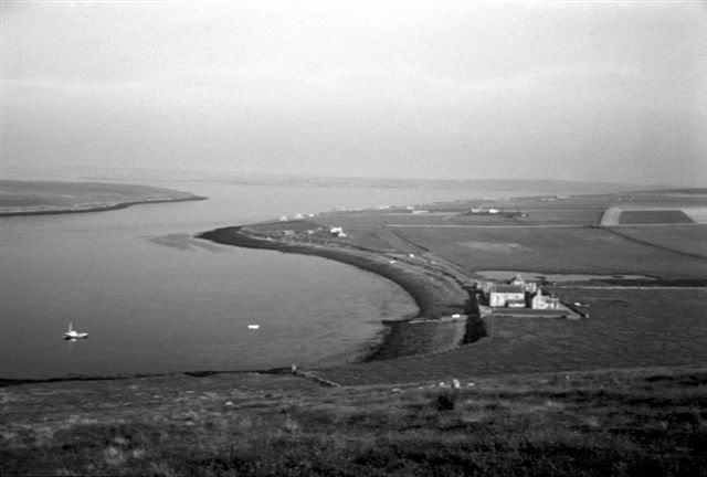
(Pictured: Carrick House, picture courtesy Peter Burges, 1970)
It's very wet and muddy on the far side. Start to trudge up thehillside, above the lighthouse. Once across a small stream, I take abreak for lunch and try not to get entangled in the barbed-wire fences.Rise up afterwards and proceed up the hill, to end up on Noup Hill.Views are very good. Because of the unstable, strongly showery weather,visibility between showers is excellent. Only problem is the force 9wind that roars over the top of the ridge. You see Westray to the NW,Papa Westray to the NNW. Sanday stretches northeast. Head back southagain, but do not go back to Carrick. Instead, I make my way southacross Vinquoy Hill. Although only 76 m in height, this again offersnice views, this time over the northern part of Eday. I proceed througha few bunkers until I come out on a raod. Go southeast along it for afew hundred yards, then strike off southwest along a path which shouldhopefully deliver me on the next road. Have all sorts of fun and gamestrying to cross fencing withouth damaging clothing. Finally gain theroad from North Ayre to Millbounds, which I follow as far as Newark.Head down a track through some fanks, which then passes thorugh somefields. Crossing the fences becomes ever more difficult as they fall indisrepair. Derelict houses provide a reason for that. Turn up by ahouse that is also empty, but not ruinous. I now look out over the Edayairstrip, which I cannot reach due to an insurmountable wall. I battlemy way through bracken to the hostel, which I reach at 5 pm. Engage the heating, do my laundry in the washing-machine provided and prepare my meal. It's cold outside, and the strong wind does not help. Taking a shower is not an option conditions like that, too blinking cold.

Monday 20 September 2004

To Eday - 20/09/04

There is no mobile phone coverage in Pierowall, although at Noup Head I did manage a contact yesterday. Head off on the bus to Rapness. It's still blowy outside. Leave this very comfortable hostel with a certain degree of reluctance. The minibus picks me up at 11 a.m. to deliver me at the ferry terminal half an hour later. It's raining as we get there, so wait in the bus for the boat. This comes wallowing in through the swell, a little late. The two hour journey to Kirkwall is rather lively, particularly in that infamous maestrom west of Eday. There are white riders on the waves, and it's choppy. But at least the sun starts to come out, and once past the Galt Skerry buoy it gets positively exhilerating. Back in bonny old Kirkwall at 1.30. Make a quick phone-booking into the Eday Youth Hostel from the Orkney Ferries waiting room. Then I'm off to Safeways for shopping after a stint in the internet cafe opposite Tankerness Lane. Return to the terminal at 3.30 for the Eday & Stronsay ferry. Although the inward journey from Westray was bumpy this morning, things have calmed down since. As I sit on deck I get an emotional text message, for as much as such messages can carry emotion. This from a contact in South Yorkshire who is about to leave for Bangerland (no translation provided, sorry) to get hitched. I've been keeping her updated with progress of this trip since the start, but now I'll have to do without this moral support, at least until the end of the year. All morning, I've had messages to the tune that she was about to leave, but at 3 pm the time was there. I sit on deck in the sun, while the ferry cruises down the Wide Firth. It turns northeast at Galt Skerry, heads past the island of Muckle Green Holm and the south end of Eday, then it veers round to dock at Backaland Pier. I'm accosted by a lady with a minibus who tells me her name and that she's the taxi to take me to the hostel for £4. Eday looks empty, with only the odd house along the road. We pass a nice beach and the island's airfield, then we pull up by some old barrack type buildings. This is Eday Youth Hostel (pictured above), located next to the firestation. After Sue leaves, another car pulls up which turns out to be the hostel's manager. She shows me round the places, and after a few minutes' chat leaves me to my own devices. I arrived at 5 pm when the sun was out. This masked the fact that this place is actually freezing. As yet unaware of that, I go for a little walk downthe road to the airfield. This is called London Airport, named after the adjacent bay. It's a good one for a joke. Fancy London Airport with only one plane a week. Proceed to make my dinner at the hostel, where the temperature is dropping like a stone. After nightfall, I switch on the heaters. That means: two large rings on the kitchen stove and electric heaters in the common room. There is no-one else here. The heaters in the dorm are all broken. Furthermore, the dorm is a high-ceilinged affair, with single-pane windows. Go to bed at 10 pm under a pile of 6 blankets, but any protruding bodyparts are perishingly cold. I don't sleep properly and in the end I relocate to the Common Room to be a tad warmer. Jayz!

Pictures

Sunday 19 September 2004

Sunday 19/09/04

Just after I finish breakfast, I meet some of the other guests in thehostel. They are here to meet family in Pierowall. The weather isn'ttoo bad after last night's downpours. Walk down the village mainstreet, then head off into th eback country. My mapreading leaves a lotto be desired when I end up on the shores of Loch of Burness. I have toretrace my steps to find a farm track that leads me west past the loch,next I go north. I finally hit the road just ¼ mile west of NoltlandCastle. You can walk around the ruins of the castle. On the outskirtsof Pierowall village, I once more turn north into the golflinks. Not inuse as such due to sandblow and the activities of rabbits, who dig hugeholes in the greens. I reach Grobust beach, then clamber back over allthe barbed wires. Can see the lighthouse at Noup Head a few miles tothe west. It's a grey, blowy sort of day, and rather cold. Next step onmy expedition is a trip to Noup Head, along a winding road. It's quitepretty with some fantastic views. The road goes past the other Westrayhostel, Bis Geo. This is fairly high up the slopes of Couters Hill. Theformal road ends at Noup Farm, but a good farmtrack carries on up NorthHill, past some derelict buildings. The wind is picking up. After Itake a break, I press on to Noup Head, by the lighthouse. The fullforce of the westerly gale hits me there, and I have great difficultykeeping my footing. On this exposed headland, it's a full force 9. Imanage to labour up the hill beside the lighthouse. This is where Istand 76 metres / 255 feet above the sea, being pummelled by the wind.Views very good, all the way down the west coast of Westray and as faras Rousay, 10 miles to the south. Very cautiously, I commence thecoastline walk, southeast. It's up and down over stiles, alongprecipitous cliffs all the way to Bis Geos. Here the rain commences,and I turn inland past a pen full of bleating sheep and fields withcattle. Regain the road back to Pierowall. As I carry on back down thehill, it is positively pouring with rain and very cold with it. Walkinto the village past the school. Dive into the loos, if only to be outof the relentless downpour. Return to the Barn at 4.30. Have to be verycareful on the flagstones outside. Spend the rest of the eveninginside. On arrival, I was welcomed by the daughter of the proprietrix,with her brood of young kids. She told stories of spring nights spenton the island of Faray, between Westray and Eday. There are buildingson that island, but only one is habitable. The rainfall today waspainful in the wind.

Weblinks:
Bis Geos Hostel: http://www.bisgeos.co.uk/
Westray on Undiscovered Scotland: http://www.undiscoveredscotland.co.uk/westray/westray/

Saturday 18 September 2004

Stromness and Westray - 18/09/04

Today's activities start with a morning visit to Stromness, followed by a sailing to Westray in late afternoon, as I'm stopping at The Barn in Pierowall for the weekend. On the main road to Stromness, the bus passes a group of men pulling a truck all the way from Stromness to Kirkwall, a distance of 18 miles. They are at Tormiston Mill at 10.30. Alight at Stromness and walk down the main street. This is paved with slabs, is fairly narrow yet in use by vehicular traffic. Go up the road by the youth hostel and leave the town in a northerly direction. A scattering of showers come past. Presently head down a track to a cemetery and finally a beach. This overlooks the westcoast of Hoy, across the water. Sit there for a while before proceeding along the coastline on the top of the cliffs. Nice walk, but it's a bit windy today. Come out past the golfcourse and round the cape to the marin and the campsite. Have a spot of bother finding a path through both of them, but finally I manage to reach the road into Stromness. Children are swimming in the harbour, which would be cold. Cats are sunning themselves outside a house. Return to the ferry terminal in time for the lunchtime bus back to Kirkwall. Pass the lorry pullers at Finstown. Bus always passes through the industrial estate at Hatston before going into Kirkwall proper. Hatston also has the ferry terminal for services to Aberdeen and Lerwick. After the shopping I head for the youth hostel, and encounter a trailer full of boys and young men with blackened faces sitting amongst bags of coal. Jump on the ferry to Westray and arrive there after an uneventful if slightly lively crossing. Tell the busdriver at Rapness that I want the Barn at Pierowall, yet he manages to overshoot. He does reverse back for me. I report to the house by the hostel and am shown round by the proprietrix. It's a comfortable place, with a huge livignroom upstairs and a large kitchen downstairs. There are several bed rooms, but I have one for myself. This evening I also have the kitchen for myself. You have to place your food in larder boxes in order to keep it together. There is also a washing machine, but I don't need that. You have to be extremely careful on the backsteps; the slate slabs are slippery if wet, and the frequent showers have turned them into an icerink. After dinner, I head out for a walk. Initially, I take just a brolly, but one look to the west suggests I'd better put on waterproofs. It duly starts to rain, and by the time I reach the pier, it's blowing a hoolie and pouring it down. As if that's not enough, the rain gets interspersed with hail, which makes it a very painful experience. Darkness has fallen by now, and the cars don't see me - well, what do you expect with a dark coat and dark waterproofs. Return to the Barn absolutely dripping - long live the waterproofs.

Weblink Stromness: http://www.orkneyjar.com/orkney/stromness/

Weblink The Barn, Westray: http://www.thebarnwestray.co.uk

Friday 17 September 2004

Stronsay - 17/09/04

After the overnight rain, the world is washed clean. Head out ofWhitehall Village for a long walk. Ferry to Kirkwall is not due until 6pm. Walk down the village main street, which is characterized by a rowof neat, white-washed houses. Turn up the hill ant the end, and shortlyproceed up a side-road to Whitehall, a large farm. The road leads up toa "high" ridge (all of 43 metres / 145 ft above sea level) along whichthe island's spinal road (B9062 / B9060) runs south from the airfield.From Clestrain Farmhouse, I continue north up to the junction. It'sbright this morning and there is a nice view to the west, to Eday, fromhere. Retrace my steps and continue south past the watertower. This isa prominent feature on the Stronsay skyline, but not as conspicuous asthe windturbines at Rothiesholm. Carry on past the radiomast to theschool. Notice a dead sheep behind the hedge lining the road as Iapproach Ward Hill. As the road descends, a road brances off to theleft. Since I want to visit the Vat of Kirbister, I join this road.Overtake a lady carrying bags. Follow the signs for the Vat, through arundown looking area around Meikle Water. Go up the road towardsOdiness (farm), then turn right into the farmroad leading to Kirbuster.A cat flits into a barn at Fingeo, and another disappears amongst astack of bales. At Kirbuster, there is a track which could do with someupkeep as it heads for the coast. The coastline is punctuated byso-called gloups, of which the Vat of Kirbuster is one. Basically, as aresult of erosion, the sea eats into the coastline. The water breaksthrough a weak point, and creates a cave. When the floor collapses, agloup is created. This is a hole, through which the sea flows with thetide. When the arch collapses, which is what the Vat will be headingfor, the coast is further indented. I proceed past Two Castles, ajoined stack, again a product of erosion, and up the side of BurghHill. Head southsouthwest towards Lamb Head. A myriad of fences forceme to carefully pick my way, but the detailed Explorer map helps a lot.The time being 1pm, I walk straight into the glare of the sun. Finallymanage to gain the shoreroad. See the farm buildings at Cleat to myright. Had to choose carefully which fields to traverse - sheep are ok,but I dislike cows and bulls. Proceed west along a rough track until Icross a cattlegrid ½ mile north of Housebay. Sit down for a bit to eatas farm vehicles rumble past me. They are taking in the harvest. At2.30, I head up the farm track, which goes up past Mid House. Then itturns into the main B9060 road. After 1½ miles, I run across the localstore, which I plunder for provisions. It's turning into a very warmafternoon, and I cannot resist the temptation of the beach. So I headdown a lane at Ward Hill and end up at the southern end of a shortstretch of beach. Have some bother ploughing through the dunes to thetideline. Head north for half a mile, then have to return to the mainroad. Again lots of fun in the duens, trying not to break a leg in thenumerous rabbit holes. I regain the road via a rough track leading upto the radiomast. Take the shortest route down to Whitehall Village andsit down on a picnic bench just behofehand. Again, nice views comingdown the brae, with Sanday 6 miles to the north. Nip into the villagestores for a drink and drop my daysack off at the hostel. Go for a walkto the east of Whitehall along some dilapidated houses to what lookslike a wrecked pier area opposite Papa Stronsay. Pic up rucksack andvacate the hostel at 5 pm, to wait for the ferry round the corner. Thehostel manager comes after just as I'm about to board the ferry, askinghis key back. He's got it back, in the box on the door - as perprocedure. Pleasant little place, is Stronsay, but the hostel was adefinite turn-off. Return to Kirkwall at 7.40, after being overtaken bya jetskier outside Kirkwall harbour.

Thursday 16 September 2004

Stronsay - 16/09/04

It's a chilly morning, which I spend going down to the visitor centreat Tormiston Mill. This relates to the burial mound at Maeshowe. Itwould have been posssible to actually go into the burial chamber, but Ihave to be back in Kirkwall on time to pick up my rucksack, do theshopping and jump on the ferry to Stronsay. The tours to maeshowe setoff at fixed times, and I can't make it for the bus. So, I just potterabout the mill, then head back on the bus to Kirkwall. After theshopping, I pick up my pack and head for the ferry. This leaves at 4pm, and makes for Eday first. A fishfarm is tied up near the pierthere. After all the cars and vehicles have gone off and on, we headeast for Stronsay. The ferry has to make some manoeuvres to negotiatesafely into the berth. There is a colony of monks on Papa Stronsay, andseveral of them travel on the ferry. They are easily identified, cladin black robes and cowls. After docking at Whitehouse Village, themonks carry on by boarding a separate vessel for Papa Stronsay. Thisisland lies across the bay. Currently, several new cells are underconstruction there, one for each monk. I head off the pier, and when Iturn right, I'm at the hostel. The door is closed, so I report to thechipshop nextdoors. I'm ushered into the hostel, which is cold, bare tothe Nth degree and not comfortable. By the grace of God I am allowed toswitch on the heating. The kitchen is the barest of bare, although oneof the cupboards is chockablock with ingredients for baking. After Iheat up my stuff, I have to drag in a chair from the dorm to sit downat the table. Christ! After supper, I settle down in the dorm, which isnot very spacious. Later in the evening, I flee the cold and gloom forthe hotelbar across the road. By that time it's started to rain. Have anice chat with various locals who say they're short of a GP. Wrongprofession. Spend a very pleasant two hours there, and am sorry to haveto leave at closing time. On return across the road, I manage to get ahot shower, then turn in for the night.

Weblink: http://www.stronsay.co.uk

Wednesday 15 September 2004

Sanday - 15/09/04

Am due to return to Kirkwall this evening, but still have all day foran extensive walk. Set off at 10 o'clock in a bitingly cold wind,blowing in straight from the Arctic. Walk up the road, parallel tothe shore and come out at Newbiggings on the B9068 to Burness. Crossover into a farm access road and traverse a field. The track gets evermore difficult to follow, as it leads through nettles and brambles.Manage to regain the road along the airfield and head west, past theschool to the junction with the road to Kettletoft, the location of theold ferry terminal. Turn north for about 150 yards, then head westagain alon gthe B9070 past Bea Loch. have a look round the buildings byWaterhall Jetty. Walk back along the road past Ayers Rock at 11.30, andnow I unsuccessfully try to make my way back to Westbrough. I'm surethe local cattle appreciated my attentions, but I had to double back tothe B9068. Head WSW along the banks of Lamaness Firth, and circle thebanks of it through the new houses at Colligarth. A track veers offinto some dunes at Colli Ness, which is where I stay for my lunch. Thisis disturbed at regular intervals by the local cattleherd, whichstampedes off when I get fed up with them and shout at the dumbcreatures. At 2.30, I head into Lady village and pop into theconvenience stores for some bits. I then head further east into a sideroad that passes through a cluster of houses. Typically disorganised -goats, pigs, cats all over the road. I once more head into the shoresof Otterswick for a cuppa, then head back for Ayers Rock. This goesback along the airfield and through a shortcut by the school atBroughtown. Have to wait for a wee while for the minibus to turn up at4.40. It goes into Kettletoft first, then heads down the island's mainroad to the ferrypier at Loth. At Warsetter, cows have jumped over thefence into the road. Nice landscape of dunes around here - someone isbuilding a house. Arrive at Loth in good time for the ferry. Thisleaves at 6.10 pm, taking me back to KW in 2 hours. It's an uneventfuljourney. On arrival there, dusk is falling. The YH still has a placefor me, after I've been and done my shopping at Safeways.

Tuesday 14 September 2004

Scapa and Sanday - 14/09/04

Start the day by booking my accommodation in Sanday, which will be at the Ayers Rock hostel. Then head into town for some purchases, such as a scarf, woolly hat and gloves. It's getting decidedly chilly now, although it's only mid September. Walk down the road to Old Scapa. it's brilliantly sunny. The main road to Orphir veers off after a little way, but a narrow single-track affair leads on to the shore at Scapa Flow. Sit in the sun on the retaining wall looking south to the hills on Flotta, South Ronaldsay and Hoy. Walk on to the Coastguard Station, where a memorial plaque indicates that HMS Ark Royal was sunk not far off-shore in October 1939, with the loss of 800 souls after being torpedoed by a German submarine. A simple green buoy marks the location of the wreck. Proceed round the bay towards the pier, but cannot reach it - restricted area. People are walking their dogs on the shore road as I return to the Youth Hostel. Later that afternoon, I disappear on the ferry to Sanday. It's a fairly sunny day. North of Shapinsay, the ferry branches off northeast at the Galt Skerry buoy. We head north of Shapinsay and south of Muckle Green Holm. The latter is a small island, with a ruined house on it. We end up in a rough piece of water south of Eday, then head NNE for the Loth terminal on Sanday. As I leave the ferry, the zips collapse on my rucksack and the contents spill out onto the slipway. Fortunately, the raincover keeps everything inside, but the minibus driver gets a bit ratty with me. Well, I can't help it, can I? I heave everything into the minibus, anger the driver even more by not having the exact far and get dropped off outside Ayers Rock at around 6. The lady of the house shows me round to the converted byre, where I'm the only guest. There are 2 or 3 dorms, a bathroom and a very cramped kitchen. Once I've laid out my wares, I proceed to the kitchen for supper. Cannot open my cans, because there is no can-opener about. So, I have to knock up the proprietrix for that item. Later in the evening, I can use the internet for a bit. It's windy outside.

Pictures

Monday 13 September 2004

Return to Kirkwall - 13/09/04

After some gentle ambling around in the morning, a little way up the road &c, we are transferred to the airfield at 4 pm. The survey vehicle for the airstrip has a door missing, which means that the driver will have to wear waterproofs at all times. have a natter with other passengers who await the plane. Some of them have come up this morning just for a daytrip. The plane turns up on time, everybody and everything gets hoisted inside. Say good-bye to the hosts at NRBO. The door closes, pilot turns round and says: "Have we all had a nice day? OK. Are we all strapped in? Let's head back to Kirkwall". Which we duly do. It's a nice afternoon, as we cross Sanday, pass between Stronsay and Shapinsay to land at Kirkwall at 4.50. The airport bus drops us off in town outside St Magnus, where my partner hails one of her taxi-driver acquaintances. He brings us up the Old Scapa Road where a bed has been organised for me. The Canadian Indians are still about in the hostel. Later that evening, I'm shown a shortcut to the Safeways supermarket on Pickaquoy Road, a Co-op is located up the road.

Sunday 12 September 2004

North Ronaldsay - 12/09/04

The weather is absolutely foul this morning, pouring rain and a full gale. A fishing vessel is nonetheless out in the NR firth, between this island and Sanday to the south. As the day wears on, the weather relents somewhat. The wind drops to force 6, and the sun puts in an appearance every now and again. I venture out alone just before midday, and head north along the island's west coast. After just over an hour, I reach the northwestern cape at Tor Ness, and veer east. The wind is now in my back. Have some very awkward clambering to do outside Westness House, and things don't get any easier around Garso. I resume the main road at Garso and head back to NRBO, where I rejoin my partner. She's been having lunch in the restaurant. I've gotto have something as well. Later that day, have a look down at the pier, where we were supposed to have landed on Friday. It's got a very nice beach behind it, South Bay. Forgot to mention the standing stone and the loch at Gretchen to the north of the Observatory. Watch a movie with the family who run the centre, and have a beer. Start preparations for departure tomorrow. This hostel is actually quite nice, well kitted out and fairly modern for its size.

Pictures

Saturday 11 September 2004

North Ronaldsay - 11/09/04

Today dawned foggy, you can't see a thing. The clashing habits continue, god, women! After breakfast, we go out for a walk across the island. The fog slowly lifts as we proceed north past fields to the airfield. We resume the road for a little while, then head north. The murk lifts very, very slowly as we return south, branching left at the war memorial. Stop off for lunch at one of the island's two pubs. Get into a right old discussion with the landlady of the Burrian. The landlord has a jewelry workshop round the back, which I'm shown round. Have to go through some very untidy bedreooms. As a said before, the landlady is right into a subject (which I cannot remember - I'm writing this a year later). Her house is full of paper, and she's quite frustrated that she can't seem to get the other islanders on board with it. But when you start to call them 'stupid' for not going along with an idea, that is not going to be a guarantee for success. Carry on down the road leading south. The local school stands on a hill overlooking the main road. A bull is roaring in a field nearby. Reach the shoreline at Howar, and we carry on outside the NR sheepwall. A large colony of seals, with one large bull guarding his harem. The sheep dabble amongst the seals, eating the seaweed. Spend quite some time there, then slowly head east. It's tricky walking in this rocky terrain, and you've got to watch your footing. The sun comes out by 4 pm, as we're heading round the corner to Bride Ness. Here we work our way inland again, and head up the road towards Hollandstoun. As I've said at the time of my first visit here, on 8 September, I'm not impressed with the general state of the place. Return to NRBO before 5 pm. Have some fun with cats, dogs and other wildlife. After supper, we have a drink in the lounge bar at the observatory. Night has fallen on return at 10 pm. The other thing is that the main door into the dormitory is very low, so I manage to bang my head on the lintel at regular intervals. Oh, and I'm out and about now for a whole month.

Pictures

Friday 10 September 2004

North Ronaldsay - 10/09/04

The North Ronaldsay ferry is scheduled to leave at 9.00 a.m.. Mr Eunson very kindly drops me off at the bank and the ferry terminal, at 8.20. You'd think that arriving 40 minutes ahead of departure time leaves you plenty of time. Nope. The quayside looks suspiciously empty, and there is this fast vanishing dot on the northern horizon, which is the ferry. We speak to the man in the Orkney Ferries shed, and he says that the ferry left as soon as everything and everybody that the skipper was expecting was on board. So he upped and left, 45 minutes early. This leaves me temporarily flummoxed. I hop on the airport bus from the bus station, and when I arrive there by 10 o'clock, my partner in travelling is already there. We book seats on the 4.50 plane, for just £12 return. We return to Kirkwall to lambast Orkney Ferries. She calls for the manager, and complains that she has had to forfeit a coupon on her all-islands travelcard. No problem. She gets two free returns to any of the North Isles for BOTH of us, although I just stood there, the manager concluded that I had also been financially inconvenienced. The company were in the wrong, and they knew it. We both went outside, walked up the street and fell about laughing. Two broad grins carried on through Kirkwall and went on a walk around the foreshore. Past the lifeboat station and the housing estate to the Bay of Weyland. Yesterday was very summery - today it's cold and grey. Carry on up the coast past Craigiefield, then head back into town. Next port of call is St Magnus Cathedral, where I'm plonked in a room to view a video presentation, whilst my partner yaps away to other folk. Right. Finally, after some shopping, we head back for the airport. The plane departs nice and on time, to deliver us to North Ronaldsay at 5 pm. A jeep is waiting to take us to the Bird Observatory, a mile to the south of the airfield. The hostel is a converted byre, two bunkbed rooms, a bathroom and kitchen. The lady and I seem to have conflicting habits in hostels, so that needs some sorting out. The NRBO also has B&B facilities, with a massive dining hall. This affords a magnificent view to the south and west. The managers have a playful dog. At the back of the garden lies a compost heap. A small windgenerator whirrs away, providing electricity.

Thursday 9 September 2004

Shapinsay - 09/09/04

I booked in with the Eunsons for two nights. Leave for the Shapinsay ferry with only a daysack. The boat goes at 10.45 and deposits a fair number of people on the island. I start off by taking a peep through the gates of Balfour Castle, only a hop down the road. Then I set forth down the village main street. Now, Balfour used to have a tidal loo. Everything you did in that wee hoosie would be washed away with the next high tide. Obvious disadvantage being the smell during low tide. Balfour main street is cobbled and lined with low houses, originally for servants at the castle. Outside the village, I catch up with a lady in a bright yellow jumper who is out on a daytrip herself. She is following the tourist guide. At one point, we pass a farm pond full of ducks and geese. At a church, we part company again, the lady goes to have a look inside the roofless building, whilst I carry on east. Opposite the road leading north to Haughland, I walk down to the shore at Haroldsgarth to have a cuppa. Look south across the water to Orkney Mainland. At 11.30 I continue up the road to the north and once again come across the lady in yellow. She is lying in the hay, watching two cows mounting each other. She expresses envy at their activities. I cannot suppress a few ribald comments on my part, and we carry on together. First of all, we go and have a look at the Mor Stein, a standing stone a little way off the road. We carry on north and 1 km further on turn left through farming country. A country road leads further north to Kirkton. There we cross west to the beach at Swartaquoy. It's quite warm and sunny as we head down to the sandy shore, with pebbles further back. Children are playing here and there. Other islands can be seen on the far northern horizon. After a lunchbreak and some paddling in the sea, we encoutner the piece de resistance: the Ouse. This is a tidal inlet with a very tricky crossing. Three wrecked cqars spoil the scenery. Further problems arise because of barbed wire. We head down a farmroad to a shop on the B9058 road at Astley Cottages. Treat ourselves to ice-cream. The road veers downhill towards Balfour. In the near distance, the valley of the Mill Dam Reserve looms up. This is a former loch, which is reduced to a wetland bog. Not much happening there in terms of wildlife. Back in the village, we have another icecream whilst waiting for the 4.45 ferry. The lawn off the pier is very pleasant for a spot of sunbathing. I get along fine with the lady, and ask her out for a meal on return to KW. She is more than happy to accept that. We natter our way to the town. Take her to a chinese place in one of the backstreets, which serves quite an acceptable meal. No, nothing else happens. We just got along fine. She invites me along to North Ronaldsay for the weekend, and who am I to decline? At 10 pm, we go our separate ways.

Pictures

Wednesday 8 September 2004

North Ronaldsay - 08/09/04

Today's activities start with a search for new accommodation in Kirkwall. The TIC are very helpful and fix me up in an address at the eastern edge of the town. Have to go up the hill past Orkney College on to the Berstane Road. As the road rises, the view widens to the west and south. can see a large school complex to my right. It's a nice, sunny day today. I finally reach Viewfield Terrace and knock on the door of number 3, where mrs Eunson affords me a cordial welcome. Pleasant bungalow in a cul-de-sac. Get along very well with the Eunsons. After a cup of coffee I return to Kirkwall, more specifically the airport. There is a dedicated bus which runs hourly. At lunchtime, I report to the inter-island desk at the back of the lounge,. Yes, I can go out on a return to North Ronaldsay. I have a couple of hours. When the time comes, I'm shepherded to a small, 8 -seater Cessna. You need to be failry gymnastic to prize yourself on board. Once everybody is strapped in, the pilot joins us. It's a case of "Everybody strapped in? We all happy? Let's go". Safety brief? What's that? We taxi to the runway where we accellerate for take-off. The hills above Finstown loom up to the left, then we veer north-northeast over Kirkwall, along the east coast of Shapinsay. We fly at 400 feet, and in the brilliant afternoon sunshine the sandy bottom can be seen underneath bottle-green seas. After ten minutes, we pass straight over the airfield on the island of Sanday; can even read the sign on the airport hut. It's quite interesting to see the islands from above. For instance, the number of ruinous buildings is quite high. Presently, we lose height on the approach to North Ronaldsay, and we land on the grassy strip at Hollandstoun. I can walk straight off the airfield, others wait for their luggage to be unlaoded, which only takes a minute. I set off north along the main road, a single-track affair. The houses here look rather run-down, and the place has an air of neglect about it. All around the island a wall has been built designed to keep the sheep out. The NR sheep live off seaweed on the seashore. Veer right in the direction of the two lighthouses on the far eastern point of NR. Pass Park House. The lovely sandy beach of Linklet Bay can be seen stretching south. I finally end up by the Old Beacon on Dennis Head, ¼ mile south of the present lighthouse. I have a nibble on the very rocky foreshore, beyond the wall. A clutter of unhappy looking sheep are ferretting about among the shingle. Can't stay long, so I quickly head back. I take the side-road to Garso. After the farmhouse, the road degenerates into a path. A hillock looms up to my left - the sea a little way to my right. Follow the road through the 'settlement' of Anamtown, then head back to the airfield. Have a natter with the airport crew and other passengers, until the plane reappears. The flight back is uneventful. I had a strange encounter at the airport in Kirkwall. Having collected my bags, I walked outside and noticed the hosteller from Papa Westray who was going to stay there for a month. Well, it's only 5 days down the line, so he never lasted. After the morning mists, the sun has come out at lunchtime. had supper in KW, then went to a lack-lustre ceilidh, which was connected with the science festival. I managed to keep my eyes open until 11.30. On return to Viewfield, I walked up the Berstane Road to encounter several cats out on the prowl. On erolled in the grass, wanting me to tickle her tummy and following me. The other sat on a wall and I snapped it with a camera. Had quite a pleasant chat with the Eunsons before retiring for the night.

Pictures

Tuesday 7 September 2004

Back to Kirkwall - 07/09/04

Today, I'll be leaving Shetland to return to Orkney. At breakfast, I'm having a very pleasant conversation with a South African lady who is touring Scotland. She is going to Mousa Broch today. After flapping about in town for a bit, I jump on the bus to Sumburgh at 12, together with the SA lady. She gets off at the top of the hill from Mousa; I carry on to the airport. Plane not due to leave until 3.30, so I go for a walk round the airport. It's a pleasantly sunny day. Leave the terminal and turn right, past the end of the runway and on to a beach. A RIB is launched as I'm sitting in the dunes. Nearby is the Viking site of Jarlshof, which is comparable to Skara Brae in Orkney, but not as old. A boat leaves from Sumburgh to Foula. At length, I return to the airport to wait. YAWN. We finally, finally take off at 4pm, to arrive in Kirkwall at 5. I'm delivered outside the YH by the airport bus, but now there is no bed for me. Didn't book it. Try the B&B across the road, but no luck. Hobble into town and seated outside St Magnus I start to ring round. The St Ola hotel on the harbour still has a room. For £34 I get a posh, high-ceilinged, en-suite poo-poo room. Don't do a lot for the rest of the evening.

Picture

Monday 6 September 2004

Cycleride - 06/09/04

I start by going to the post-office, to the baker's for lunch and the hairdresser's. All in Commercial Street. Another sunny day, so I decide to go out on a rented bike. There is a bike and car rental place up the road, and I'm duly issued with a mountainbike for £7 for the whole day. At 11.30, I head out south down the A970. In a car, you don't really notice the inclines. On a bike you do. After the Clickimin roundabout, I'm pretty quickly puffed out. I follow the same route as yesterday, and head out towards Scalloway, 6 miles to the west. Just before the junction at the far end of the B9073, I take a wee breather. Then I go down that long and steep hill towards the Tingwall valley. Nice viewpoint about 1/3 way down. I'm not really happy to go thundering downhill, but I do manage to get to the bottom without mishap. Go uphill into Scalloway and ride around the harbour. Return to the far end of town, where I head south down the road towards Burra. It's getting fairly warm - sun is beating down. After a mild incline, the road veers west to cross a narrow bridge. Once vehicle can cross it at a time. After another short break on the far side, I press on and finally arrive into Hamnavoe. I proceed through the village. I'm now 10 miles from Lerwick and 4 south of Scalloway. It's 1 pm, so I've done well. Nip into the shop for some bits, then sit down at the harbour to eat lunch. Nice views to other islands. At 1.30, I head back up the hill and run into a funeral procession that is just setting off from the church. Turn off to the right at the roundabout and head down to another beach. Park the bike at the toilets and wander down the path. Several people on the beach. I proceed past the beach and up the hill. Path leads a little further, but I'm happy just to sit and enjoy the sun. At 3 pm, I head back to Scalloway. Just before the town, I go into the Tingwall valley, which I ride along its full length. In the village at the other end, I dive into the pub. It takes a while for a bartender to appear, but that pint of coke went down a treat. Had a chat with some of the locals, them jumped on the bike again to labour uphill to join the A970 back to Lerwick. By now it's 4.30 and very warm. This road is the arterial route through Shetland and I have cars, lorries and motorbikes flying round my ears. The orad is on a relentless downward slope to veer around a valley a 2km descent. At the bottom, the sideroad to Scalloway veers off south, but the A970 veers round the head of the valley and goes uphill again. The incline beats me, so I'm reduced to walking the bike up the hill. It is so warm and I'm perishing with thirst. Toil up the hill, then bomb down it on the far side, racing into the Lerwick rush-hour at quite some speed. A long line of cars waits at a roundabout; it's 5.30 and all are trying to get hoome. I deposit the bike at the shop and head into town for supper.

Pictures

Sunday 5 September 2004

Bressay and Shetland tour - 05/09/04

Lerwick is deserted on Sunday morning. Go up Charlotte Street, come out by the Town Hall and the Museum at the top of the hill. It's 10 a.m., but nothing stirs. Return to the town centre to go on the first ferry of the day to Bressay. It drops me off there just before 11, giving me about an hour to hare round the island. From Bressay, you can actually cross to the nature reserve at Noss, but I won't have time for that. My tour starts at 1 pm. Walk down the shore road to the school and shop, then proceed to the little housing estate at Glebe. From here, a track winds uphill to the summit of the Ward of Bressay. Because of time-constraints, I can't go quite to the summit, so I turn back. Walk back to the pier via the Gunnista Road. Hop on the ferry and am back in Lerwick at 12.20. Have something like lunch in a takeaway bar at the harbour and eat it on a bench in the bright sunlight. A very large, yellow fishing boat from Whalsay is in port. Report to the TIC at 1 pm, where a pleasant lady, Sarah, is ready with her minibus for today's tour. We set off, with a compliment of 8, down the A970 to Hollander Knowe, from where the B9073 provides a shortcut through to Scalloway. This has the ruins of a castle. Scalloway used to be capital of shetland. We continue north, through the valley of Tingwall. This means Valley of the Althing, the old viking parliament. Nowadays there is the Asta golf-course. On the island at the northern end of Loch of Tingwall, called Law Ting Holm, judgement would be passed in the Viking era. If the culprit managed to outrun his executors and the rest of the crowd (who were all at license to carry out any death sentence) and reach the church, he would be safe. We proceed past Tingwall Airport up the A971 to a long stretched-out series of settlements on the Weisdale Voe. At the top of the Voe, we carry on north to Kergord, which has the only woods in the whole of Shetland. This is latitude 60°N. We rejoin the A970 and carry on to Voe village. We leave the A968, which branches off to the Yell ferry, to our right and carry on along the shore of Olna Firth to Brae. Just over a mile to the west lies Mavis Grind. That is not a female, but a narrow isthmus. To the west lies the Atlantic, off Mangaster Voe, to the east the North Sea, from Sullom Voe. The oil terminal at Sullom Voe is situated 6 miles to the northeast, but this complex is clearly visible. Oil has brought wealth to Shetland. For every barrel of oil that passed through Sullom Voe, Shetland Council would receive 1p. To date, this has amassed to a staggering £1,000 million pounds! Carry on north for another 6 miles, then fork west in the direction of Hillswick and Eshaness. Visibility is poor today; Foula nor Papa Stour are visible to the south and west. We go north briefly to Ronas Voe. This is a spectacular Shetland Ffjord, over which Ronas Hill towers at 450 m / 1500 feet. We alight from the minbus and enjoy the vista. Clouds clear from the summit of the mountain. Next port of call is Eshaness Lighthouse, about 7.5 miles to the west. This is situated amidst some spectacular coastal scenery, resulting from dramatic coastal erosion. The lighthouse is automated, but the outbuildings are occupied by a writer. She has just left for the winter. Out to the south sits Dore Holm, a natural arch that looks liek a crouching elephant. Finally, after about half an hour of looking round, we toddle off to a museum at Tangwick, which shows life in Shetland in times gone by. At 4 pm, we drive off under a glazing sky, back down the 35 miles to Lerwick. Shetland is bigger than you'd think from the map. We're overtaking by a motorcyclist who tops 100 mph. The descent into Lerwick is down a very long and steep hill. One of our group gets dropped off at the ferry terminal to go on the 7 pm ferry, the rest in Market Square. I dawdle around for the next piece of excitement: a trip in a replica Viking Boat, the Dim Riv. At 7pm, a group of seven are issued with life jackets and we board the boat. We motor into the haroubr, until we're abreast of the ferry terminal. There we cut the engine, and the sail is raised. Slight problem: we have wind force zero this evening. Oh, we do make headway tonight, but that's the tide carrying us south. I've been told that this boat has been as far as Dublin. She can be rowed, but us poor tourists are spared that ordeal. Once abreast of the harbour, we allow a skiff with 8 rowers to go in first, before we motor into port at 8pm. Go to the Queen Hotel for supper. They take their leisure at serving, but ok, it does come.

Pictures

Saturday 4 September 2004

To Shetland - 04/09/04

Last night, I booked a weekend trip to Shetland by plane. I head out to Sumburgh Airport at around 1pm, to return on Tuesday afternoon. There is a dedicated airport bus, which I join at midday outside St Magnus' Cathedral in Kirkwall. It's a large red minibus, low floor access. It's £2 single and £3 return, the return being valid for a month. On arrival at KW airport, I check in and proceed with my pet-hate: wiating in an airport departure lounge. Finally, well past departure time, we're called to go into the plane. It's turboprop affair with 133 seats and one stewardees. I sit behind the engine/ wing. The doors are closed, the emergency drill rattled off and the propellors start up. Finally, they begin to buzz like a swarm of angry wasps and we move off the stand an donto the runway. The buzz rises to a crescendo on take-off. We rise above Orkney Mainland and head northeast. I sit on the righthand side of the plane and am therefore deprived of the view over the North Isles. In only see Fair Isle from 6,000 feet up. At length, we commence the descent. Prior to departure, we were issued with weather letters by Loganair. These are a notification that weather conditions at Sumburgh may make landing impossible and that the flight stands to be delayed or cancelled. By the time we reach Sumburgh, the fog has lifted. We descended to very low over the sea, then the runway appeared and the plane slowed, landed and went right up to the terminal building. With the time at 3pm, I marched up to the busstop, only to find that the next bus into Lerwick won't be until 5.30. I return to the terminal, buy some info and decide to shell out on a taxi: £32! However, I need to be in Lerwick before the TIC closes. I did not book accommodation in advance. The taxi driver takes me up the A970 to Shetland's capital. He tells me all manner of stories of local interest. At Cunningsburgh, the hills are bare rock, stripped of their layer of peat last year. A period of drought had dried out the peat, which was duly washed down the hill in a torrential downpour. The road went as well. Finally arrive into Lerwick at 4pm. I'm dropped off outside the TIC in Market Cross, in the middle of the town. Join the Q to book accommodation. I am referred to Fort Charlotte Guesthouse, on Charlotte Street, further up the town. I also book a guided tour for tomorrow, Sunday, which will take me round Mainland Shetland. After a stint on the Internet at the TIC, I go to Charlotte Street. Have to walk the length fo Commercial Street. This is the main commercial centre, paved with slabs and open to all traffic. I'm met at 1 Charlotte Street by proprietor Jim, who shows me to my room, no 5, on the topfloor. Small but comfortable room. Jim owns a fish & chips shop where I go to have my supper a bit later. Proceed on a walk round the town, to Fort Charlotte. This is a Territorial Army base. Return along the seafront, where some Scandinavian style buildings line the haroubr. Shetland considers itself to be more Viking than Scots, and Lerwick looks faintly Scandinavian. There are no highrise buildings. Have a portion of fish & chips at Jim's shop, which I consum on a bench by the harbour. Then I head out along Commercial Street, past the Market Cross and up the hill. Walk round the peninsula of the Knab, past Breiwick and the local cemetery. Nice views over the outlying housing estates of Lerwick, and south along the ocast. The return takes me high above the sound bdetween Lerwick and the island of Bressay. I head down the hill through another housing estate and reappear in Commercial Street. On return to Charlotte Street, I spend the rest of the evening watching telly.

Friday 3 September 2004

Friday 03/09/04 - Papa Westray

The day dawned nice and sunny, but that wasn't to last. I set forth at 8.45, with Paul joining me as far as the airfield, carrying his coffeemug with him. Jeez. The plane comes and goes. We pop into the waiting-room at the airport, where I put my waterproofs on. Paul returns to the hostel, whilst I continue to the coast. The rain starts gradually, intensifying as I go. After a lot of bother with fences near the seashore, I reach my first reference point, St Boniface Church, at 10 a.m. It is dedicated to a man who was murdered in 754 AD at Dokkum in Holland. Have a look at http://www.papawestray.co.uk/papay/pw_official6.html. The church was rebuilt by the local community and taken back into service in 1990. Very small but pleasant building. I leave with a certain reluctance, partially due to the awful weather. I carry on north and finally reach the perimeter fence of a nature reserve at the northern end of Papay. The birds left several weeks ago, and I find myself trudging a sodden moor. The coastline veers round to the east. As I'm holding a high contour, I'm not presented with awkward surprises. Reach the northern cape at 11.15 and proceed south. Encounter two people on my way past various geos and cliffs, finally regaining civilisation at 12.30. The rain is beginning to let off as I make my way south. Not quite sure whether to stay high up or low down, I stick to height. I end up getting zapped by an electric fence before regaining the road. Return to the hostel at lunchtime. Just before the hostel are the local school plus health centre. Behind the hostel, in the same building, is the shop. They open at 3 today, rather than the usual 2.30. Some of the island ladies complain bitterly, particularly as someone had to come from afar. Yep, this island measures 6 km north to south, longest road distance 4 km. Having obtained my shopping in the confined space of the shop, I walk round to the other side of the building. Gather up my stuff from the hostel and start walking towards the ferrypier. Only a few hundred yards outside Holland Farm, the hostel warden pulls alongside to offer me a lift to the pier. I arrive there at 4.15, a wee bit early. Golden Mariana appears at 5 o'clock, to take me back to Pierowall in the statutory 23 minutes. The connecting bus returns me to the ferryterminal at the far end of Westray. A chilly wind blows, so I wait on the bus for the ferry to turn up. Thereturn trip to Kirkwall is uneventful, and we reach the town before nightfall. I manage to get a place at the youth hostel. There are some unusual guests in. As I'm heating my food, a gentleman who looks like (and actually is) an American Indian lights the hob on the next stove. He takes out a handdrum, about 30 cm across, and holds it over the flames. Concerned, and inquisitive, I ask him why he is doing that. "Oh, the drum is very moist it I need to dry it". The man is a member of a large group of Canadian Cree Indians who have come to Orkney to investigate their roots. In the 19th century, groups of men from Orkney emigrated to Canada. Some of them married native girls and the descendants have come back now. They are decked outin full regalia, as part of the Kirkwall Science Festival this month. They give performances of traditional dances in venues around Kirkwall over the next 2 weeks. Meals are provided by local ladies who cook in the hostel kitchen. The group are nice enough, but a little inconsiderate. If they want to go out, they do so through the nearest door. Even it's alarmed. At 7 in the morning, they start to sing and beat their drums, to the annoyance of other hostellers.

Pictures

Thursday 2 September 2004

Thursday 02/09/04 - Monuments and Papa Westray

After breakfast, I head into Kirkwall to go on the n° 8 bus. This is a tourist service, on one of its last runs of the seasons. We head down the Stromness road past Finstown, and turn off just before Brig o'Waithe to visit the first of a number of ancient sites: the Stones of Stenness, a hop and a step from the junction. These stones, only 4 of them, stand in a circle in alignment with Ward Hill on Hoy. At the winter solstice, the sun sets behind Ward Hill when viewed from that circle. The sheep within the circle were oblivious to that. When the allotted 15 minutes were up, we were herded on board the wee bus and transported a mile up the road to the Ring of Brodgar. This is a much larger monument, consisting of a circle of about thirty stones. One had been split in two by a lightning strike in June 1980. A sort-of heelstone stands to the southeast, and another stone is set apart to the northwest. We were allowed about 30 minutes to roam the circle, diameter 100 m, before rejoining the bus. Fairly sunny today. Next stop is the very ancient site of Skara Brae, on the west coast of Mainland, 6 miles north of Stromness. It dates back 5,500 years, and consists of a number of homesteads. Before I visit the actual excavations, I have to buy some maps and a cup of tea in the Visitor Centre. Also a disposable camera. Adjacent to the centre, there is a replica homestead from that era. It's very low, doorways only 4 feet high - I'm 6 feet! Interesting. Walked out along a path which was a walk back through time. From the present 2004 AD it went back to 3500 BC. Informations officers were at hand to explain. The homesteads are protected from encroachment by the sea by a strong seawall. It was erosion that caused them to be exposed in the first place. Some bits were already lost to the sea. After Skara Brae, I went on to nearby Skaill House, a former residence to the bishopric of Orkney. It contrasts sharply with the nearby ancient site. By the time I'm finished, I pick up my rucksack and head back to the bus. This returns me to Kirkwall via the other two site, which I don't really bother getting back into. The Ring is more intensively visited, and there is a coachparty of Dutch wrinklies at Stenness. They are herded off and on the Orkney buses coach. We head past Tormiston Mill and Maeshowe to Kirkwall. Do my bit of shopping for the next day and a bit, then head for the ferry terminal. You can't buy tickets ashore, they are sold on board the ferry. My ferry goes to Westray direct. You board via the vehicle ramp, leave your luggage in the locker on the vehicle deck, accept a boardingcard and head upstairs. It's a bit blustery today, so I position myself on the starboard (righthand) deck, well covered. We set off north past Shapinsay, which I first visited in 1990. See the quaint shape of Balfour Castle slowly moving out of sight. St Magnus, a conspicuous shape on the Kirkwall skyline, slowly recedes behind the vessel. We go closely inshore, halfway up the westcoast of Shapinsay, this to avoid a shallows. The ferry blows its horn at a party of walkers on shore, who are practically within hailing distance. Off the northwestern cape of Shapinsay, we can see several northern isles, as we pass the buoy for Galt Skerry. To the east lies an island with a few windturbines, which is Stronsay. To the northeast rise the barren moors on Eday. Eday's ferryterminal is on the far (that is: eastern) side of the island. Off its southern cape, the tides meet from about four different directions, so it gets very lively. The ferry sails the length of Eday's western shore, which show only a few houses. About halfway up, we encounter a stretch of very choppy waters, with many white riders. Past the north end lies Faray, which is uninhabited. At 6 o'clock, we are 'suddenly' at Rapness, the ferry terminal for Westray. I disembark and try to locate the minibus that is to take me to the next ferry, which departs from Pierowall, 7 miles to the north. Squeeze all my stuff on board and shell out £2 for the trip. We hare down a very straight but quite bumpy road. past an austere looking church and into Pierowall. We circle the bay and finally arrive on the quayside. My next transport, the Golden Mariana, is already waiting, and as soon as I'm on board, the crew cast off. Have a chat to the master and mate beforehand. We set off at 6.50 for the 23-minute crossing. Although it was bumpy on the way in from Kirkwall, the sound between Westray and Papa Westray is not too bad. At 7.13, we tie up alongside the quay at Papa Westray - which I'll refer to as Papay from this point onwards. I make an awkward step to the stairs, and am met at the top by the genial warden of the youth hostel at Holland. We drive there at a rate of knots, and duly arrive at Beltane House at 7.30 There is this cat, a beautiful ginger tom and a blackbird which always wants to go inside. The bird isn't allowed in, because once inside it suffers a panic attackand defaecates all over the place. Beltane is part youth hostel, part B&B. It has two dorms, one of which already has someone in it. This is a chap who tells me he's there for a month to watch birds. Hmm. It's September, not much to be seen in terms of birds. The kitchen is pokey and poorly equipped as far as pans and cutlery is concerned. I manage to cut myself on the baked-beans can, as a result of that crappy can-opener. Have my meal in Paul's company. Weird fellow. The concepts of table manners and proper food (:-x see my baked beans) are beyond him. I take myself off on a walk after supper and head down the road in an easterly direction. It's getting dark at 8.30, and I can see a lighthouse winking away to the east. This should be either North Ronaldsay or Sanday. I go as far as the shore, where I find a small harbour with some ruinous boats pulled up beyond the slipway. Carry on up the road parallel to the shore, and listen to the waves lapping on the shore behind the dunes. Return the way I came and head back to Beltane, where not much is happening.

Pictures

Wednesday 1 September 2004

To Orkney - 01/09/04

Said good-bye to Jess after breakfast. Train is supposed to leave at 9.47, according to the timetable. On arrival at the station a group of men are weeding the platforms and flowerbeds. The clock in the war memorial, where I had a look before going to the station, strikes 9.45. No train. At 10 o'clock, I ring the train control centre about my train. This is running 47 minutes late. Wow. The train, when it finally materialises at 10.40, is the same set of carriages that had problems at Dingwall yesterday. Passengers for the Orkney ferry are getting concerned about their connection at Thurso. Whilst we pass through the empty moorlands at Kinbrace and Forsinard, the conductor tries to sort something out. We arrive at Georgemas Jct at 11.20. Ferry passengers are asked to change into a bus, which is waiting outside the station. Arrangements were poorly made and fall to pieces. Initially, the driver is only goin gto deliver us to Thurso railway station. Furious exchanges by telephone ensure that we are taken right to the ferry terminal at Scrabster. We duly arrive there at 11.50. Too late. Although the ferry is not due to leave until 12.00, we are not allowed on board because safety procedures have to be carried out prior to departure. They require everybody to be on board 15 minutes before advertised sailing time. This would have left us stranded for 7 hours, if it hadn't been for a lady kicking a fuss. This resulted in a taxi, paid by the traincompany, taking us to the ferry terminal at Gills Bay, 3 miles west of John o'Groats. Two taxis took 6 passengers up the ocast. My taxi deviates into the countryside to drop an elderly lady off at her house. We arrive at Gills Bay ferry terminal at 1 o'clock, well in time for the 13.25 ferry. Was not aware of this ferry service, which goes out to St Margaret's Hope on South Ronaldsay. Names are taken down and £10 collected. The ferry looms up in the distance at 1.15, and meanders through the maze of off-shore skerries. After all the vehicles are discharged, footpassengers are allowed on board. The boat looks familiar. It's a bit of a rundown rustbucket, but when I ask the lady in the cafeteria, my suspicions are confirmed. A blast from the past: the Pentalina B used to ply the waters of the west coast as Iona until 1996. I sailed in her in the early 1990s, from Tobermory to Armadale and Mallaig. I even spent a night in her in an overnight berth at Mallaig in 1992. This was prior to a 5 a.m. ferry departure for the isle of Eigg on the old Lochmor as was. Back to 2004. We sail at 1.30, heading past the Isle of Stroma. This was evacuated in the 1950s, with everything left in the then state of affairs. Progress further north past Swona, with the cliffs of Hoy to the west. At 2.30, we dock at St Margaret's Hope. We make a 90° turn at a shingle bar at the entrance to the harbour. The Pentalina B looks dishevelled, poorly painted and rusty. Poor old Iona. At least she brought me safely to Orkney. Docked there too was the Claymore another ex-Calmac ferry in a dreadful state. A taxi appears to take two ladies and myself up to Kirkwall, the main town in Orkney. We have an interesting ride over the Churchill Barriers, and duly arrive in Kirkwall at 3 o'clock. I nip into the TIC, which I finally locate past St Magnus Cathedral. Gather in essential info, such as bus and ferry timetables. Then have a look inside the cathedral and the museum. Still have me rucksack on, so the tight passages in the museum are awkward to negotiate. Museum gives an interesting first glance at Orkney life. I then proceed up the road to the Youth Hostel on the Old Scapa Road. Am bundled into one of the droms after the usual formalities. Head into town to get some food in. There is a large supermarket on the Pickaquoy Road near the busstation. Make a booking to stay in the hostel at Papa Westray for tomorrow