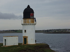
On the eastern side of Lewis, south of Stornoway, lies the district of Lochs. A loch is Scottish for lake or sea-arm. Apart from sea lochs there is a myriad of fresh-water lochs. Loch Grimshader could almost pass for a fjord, with its steep-sided entrance. The small inlet of Tob Leireabhat, just south of the Arnish Lighthouse, is similarly encased in a steep valley. Going further south, the villages of South Lochs, on the southern shore of Loch Erisort, used to be poorly served by roads. I read a book the other day deploring the advent of the South Lochs Highway (better known as the B8060). Until that road was improved, the mails were delivered from Crosbost to Cromor by boat. And in fact everything in the old days came in by boat. When the doctor had to come in an emergency, he came across the water. In a direct line, it's 12 miles from Stornoway to Cromor. Go by road, via Balallan, and you're looking at 30 miles. The people of South Lochs launched a buy-out of their estate a year ago. Their current landlord has not seen fit to lavish the district with his financial attentions, but is only too keen to cash in on the proposed windfarm development. The same applies to the owner of the adjacent Eishken Estate, to the south. Of both subjects: more later. The southernmost villages in South Lochs are Lemreway and Orinsay. There used to be a third village on the shores of Loch Sealg, Steimreway, but that was cleared in the 1920s. Not for the first time, and actually not for the last time either. The excellent Angus MacLeod archive in the Ravenspoint Centre in Kershader has published a booklet with the history of the village. These days, Steimreway is only a set of ruins in a delightful setting. Like the 30 villages in Eishken, Steimreway was cleared during the 19th century to make way for sheep. Steimreway can only be reached on foot across the open moor. I tried to reach it back in July, but atrocious weather conditions put paid to that enterprise. The village was located along a tidal inlet, the Loden, which linked to an inland water system of lochs. This makes it impossible to reach Steimreway from any other point but Orinsay. Except by boat of course. The village was repopulated between 1921 and 1945. The resettlement got off to a bad start, when a boat containing a flitting went down. And it foundered completely when the government was not interested in putting in a road or any other facilities. Familiar story?
Across Loch Sealg lie the deserted mountains of Eishken. As I stated above, until the 1820s, there used to be some 30 villages in that district. None now remain. It is a private estate, used for deerstalking. In 1887, a group of men, led by a Balallan schoolteacher, mounted a 'raid' on the estate. They shot a few deer and feasted on venison. They only wanted land. However, the estate owner would not hear of it, and engaged the sheriff to evict the intruders from her land. They were read the riot act at Kinloch Sealg, and the men departed. A monument to their endeavours stands at the junction of the Eishken road on the A859 Stornoway to Tarbert road. It is closely associated with the landraid at Aignish, Point, in 1888 where force had to be used to evict crofters. It is all about land, which is so important to the islanders. Because that's where you make your livelihood from.
Planned for the mountains of Eishken is a windfarm project. One hundred and thirty-three turbines are to be erected across the tops of the hills. Each turbine will measure 450 feet in height. This image will give some idea of scale. 
Landowner Mr Oppenheimer, currently a multimillionaire, stands to become a multibillionaire if the plans come to fruition. Comhairle nan Eilean Siar nearly rejected the planning application back in June. In his generosity, the land owner has set up the Muaitheabhal Trust, named after one of the hills on which the windfarm is to be built. A year ago, letters were sent round the Kinloch district (which stretches from Lacasaidh to Airidh a'Bhruaich) and the hamlets on Loch Seaforth. The people were invited to join the MT, which would entitle them to a share in the profits. Not joining the MT would mean no share in the profit, although Mr Oppenheimer did say he wanted the community to share in the proceeds of the windfarm. The 50 people on Loch Seaforth, who live in settlements such as Ath Linne, Bogha Ghlas, Scaladal and Maraig, scorned the idea. If memory serves, about half the people in Kinloch were agreeable. Press reports at the time mentioned £16m annually for South Lochs. Aye, fancy what you can do with that. Sports facilities and all that were mentioned. My plea, aired in the local press, for the Comhairle to come up with a development plan with all that money in the kitty went unanswered.
Update
The above piece was written in December 2005. The planning application for Eishken has since been scaled back from 133 to 53 turbines, and this was passed by the local council on June 15th. The reduction in size was made in response to concerns expressed by the Royal Society for the Protection of Birds about the resident population of eagles on the Eishken mountains. In my piece on the Arnish Lighthouse blog, my personal response was:
Loch Seaforth desecrated, the untouched wilderness of Eishken ruined, the silence of Loch Sgiobacleit broken and the Harris mountains overshadowed by windturbines. At one time there was a plot of land for sale on the Eishken road, about 3 miles out of Balallan. Glad I didn't buy it; whoever bought it will now have his view improved no end.


Those wind turbines sound a monstority, even scaled down. Jeannette xx
ReplyDelete