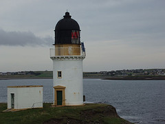
A couple of notes: the pictures were taken using a disposable camera. I'm afraid I cannot provide a map showing all the names used in the entry.

Teileasbhal - 19/04/05
Nice start to the day weatherwise, and jump on the Harris bus to Bogha Glas. Thought busdriver knew where I want off, he has dropped off by the Bardon site office before. No, he had to be told. Went up the track to Glen Langadale and branched left at the cairn [righthand side of map], to go down to the upstream ford. Bit soggy underfoot going downhill. Have a camera with me, so I’m snapping away. Found the mapcase lying where I left it accidentally on Saturday, none the worse for its 3 nights and days in the open. Tackle that messy ascent towards the pass between Stuabhal and Stulabhal between 12 and 12.45. I take a different route every time, but it remains steep and soggy. Once on the pass, I continue uphill to Creag Stulabhal, a fairly straightforward climb up a grassy incline. Once up there, I follow the edge of the crag at a safe distance – it plummets down 300 m (1,000 ft) over just 100 m. There is one very eerie viewpoint down to Loch Stuladail. The view continues to expand upon reaching the highest point of the Creag at 513 m (1680 ft). It’s a bright sunny day with a fresh wind, and temperature at a very pleasant 15C (60 F). From the Creag, the shoulder falls away to Sron Ard, southeast of Loch Bhoisimid. Can look all the way to Kinloch Resort, Morsgail and Great Bernera. In a flurry of confidence, I decide to tackle the next summit, Teileasbhal. This is a fair walk of about 1½ miles and 184 m ascent (600 ft). It’s easy going round Coire Sgurra –breac, but boulders and stone slabs start to pop up. The grass is flattened down in places, as if there has been recent snow. The way is easy to find and there is room to divert around the nastier outcrops. Meanwhile, the altitude gained begins to dwarf everything around. I stop my ascent of the mountain some 100 yards short (about 15 m vertically) of the summit,which is at 697 m (2,290 ft). Proceeding further would have meant an uncomfortable sense of exposure. This is an acute awareness of your height, and the precipitous drops nearby. Furthermore, the actual summit is very rocky. It’s 13.45, and I’m in serious mountain terrain now. The drop into the adjacent valley, to the east, is 470 m (1,540 ft); I’m well above Mullach an Langa (614 m = 2,014 ft) across the valley. To the southwest, an even higher summit can be reached by traversing a very exposed looking ridge to Uisgneabhal Mor (729 m = 2,390 ft). This is the southeastern end of a nasty-looking ridge to Sron Scourst, which towers 491 m (1,600 ft) above the valley leading north from Miabhaig. Only a few places are higher than me now; Uisgneabhal Mor, Mulla fo-Thuath (720 m = 2,362 ft), Mulla fo-Dheas (743 m = 2437 ft) and Clisham (799 m = 2,620 ft), the highest peak in the Outer Hebrides. These four peaks look forbiddingly precipitous, and I’d be very ill at ease on them. The view is unforgettable, virtually 360°. South: Taransay, Ceapabhal and Sodhaigh Beag + Mor, as well as the hills on North Uist and Benbecula. Loch Resort pops up in several places. In the bright sunshine, the house at Kinloch Resort stands out clearly, as does Morsgail Lodge. Can see Loch Roag and Bearnaraigh Beag; hazy on the northern horizon stands Muirneag near Tolsta, more than 25 miles away, and can discern the vague outline of the Barvas Hills. Can see the ferry leaving Stornoway Harbour at 1.45. Close by, Glen Langadale next to Stuabhal; Loch Langabhat curves northeast towards a very diminutive looking Roineabhal. Across the hills to the east of the loch, Loch Seaforth and Seaforth Island stand out in the sun. The mountains on the mainland march on the eastern horizon, 50 miles and more away. Skye is visible to the southeast. A view to put in your pocket and take home. Just before 2 pm, I start my descent. Have a little bother with some of the slabs, but again, I have room for a diversion or two. Walk round the corrie towards Stulabhal, then down the hill to the pass and down that horrible stretch by Gil Slipir. I dislike that boggy, slippery, stoney and steep bit. OK, return to Langadale River at 3.30. It’s so warm, incredible. Wade across the river, then go a little way up the path barefoot. Not bad, except I sink ankledeep into all the bogs. Wash the feet in a stream, then press myself hard to the road. No lunch today, incidentally, but did treat myself to marsbars and apples. Bus arrives at 5.05 to take me back to Balallan. From there, the South Lochs bus continues to Stornoway. Am well sunburned, and have taken off the waterproof overtrousers. This naturally results in my trousers getting very dirty indeed.


Interesting entry. I very much enjoyed looking through your photos. Very rugged by very beautiful country. I did get an alert for this posting but not for many other people. I have also posted today and finished answering peoples questions.
ReplyDeletehttp://journals.aol.co.uk/jeanno43/JeannettesJottings/
Beautiful pictures. Some of that isolated countryside looks like parts of California.
ReplyDeleteInteresting entry.
Pam
wow guiod! It sounds abit arduous!
ReplyDeletehugs,natalie
sheesh! guido!
ReplyDeletevery nice work
natalie